AD 1300 · 13th century · Hereford
Hereford Mappa Mundi
An east-up, encyclopedic Christian world gathered around Jerusalem on a single monumental skin.
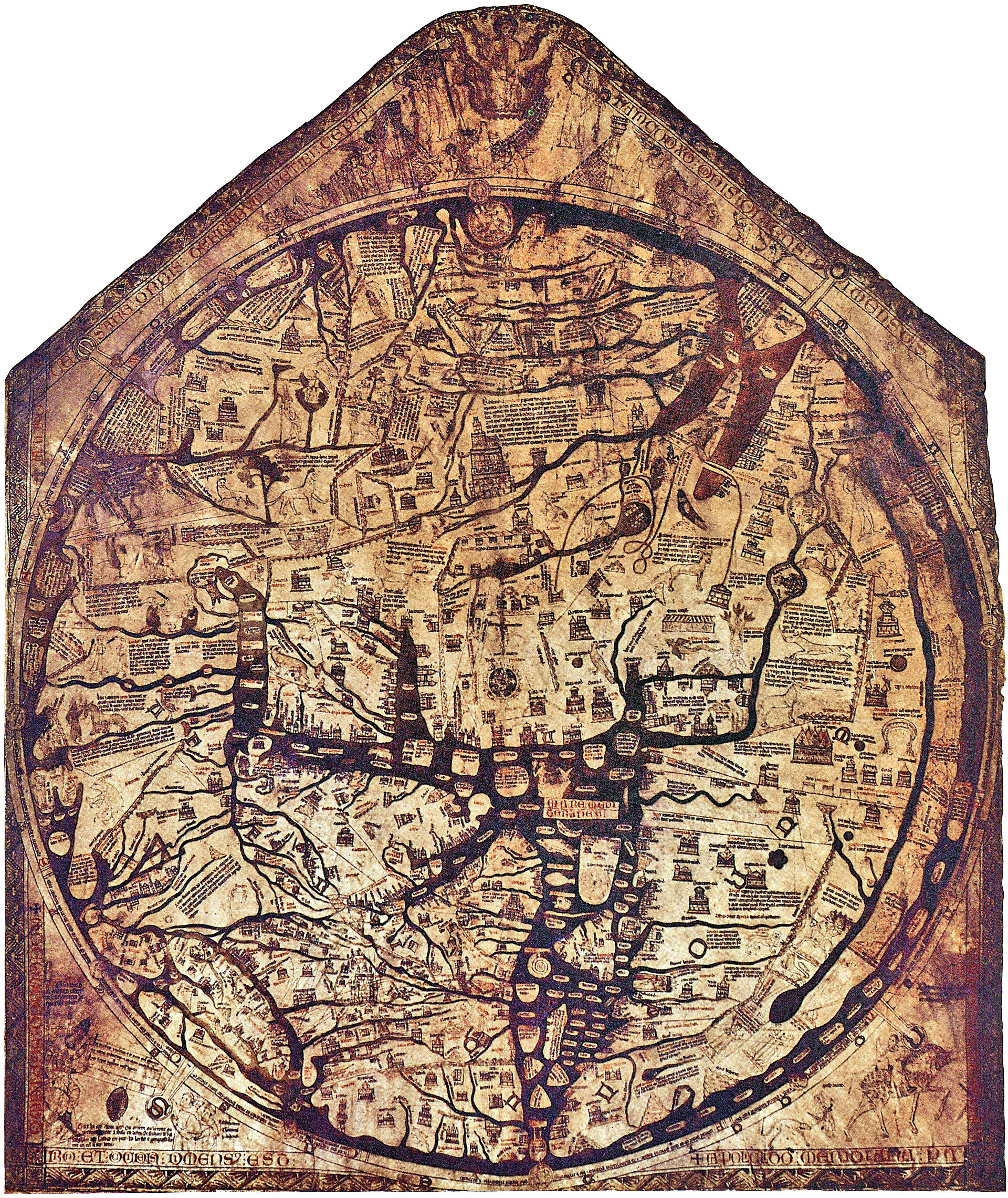
Catalogue record
| Cartographer | Richard of Haldingham (traditional attribution) |
|---|---|
| Dimensions | Approximately 158 × 133 cm; geographic circle 132 cm in diameter |
| Medium | Ink and pigments on a single sheet of vellum |
| Repository | Hereford Cathedral |
| Custody | Held by the repository named above |
Open questions
Looked at and unresolved. Listed so the gap reads as a question somebody asked rather than a field nobody reached.
- attribution
- The map names "Richard de Haldingham e de Lafford" as the author of its making, but whether that names the designer, the scribe or the donor, and which Richard he was, is not settled. The Hereford Cathedral scholarly literature on the legend and the Lincoln prebendary records behind the two candidate identifications.
Tags
- mappamundi
- Jerusalem
- east-up
- sacred centre
- manuscript
Related essays
Related maps
- Ebstorf world map · AD 1235
- Psalter world map · AD 1250
- Itinerary from London toward Jerusalem · AD 1255
Bibliography
- Woodward, David. “Medieval Mappaemundi.” In The History of Cartography, vol. 1, 286–370. Chicago: University of Chicago Press, 1987.
- Edson, Evelyn. Mapping Time and Space: How Medieval Mapmakers Viewed Their World. London: British Library, 1997.
- Hereford Cathedral. “Mappa Mundi.” Collection guide, updated 20 July 2021.