600 BC · Mesopotamia
Babylonian World Map
The Imago Mundi - earth as a disc ringed by the bitter river.
The collection
59 historical maps across every essay. Filter by century, region, cartographer, or tag - or search by title.
600 BC · Mesopotamia
The Imago Mundi - earth as a disc ringed by the bitter river.
220 BC · Alexandria
A measured earth: the first grid of parallels and meridians.
AD 150 · Alexandria
Coordinates for 8,000 places - cartography as a table of numbers.
AD 210 · Rome
The Severan marble plan survives in 1,186 known fragments, turning the mapped city into an evidence problem of joins, proposed locations and absences.
AD 400 · Roman Empire
The road as the unit of space - Dacia stretched along an itinerary.

AD 570 · Madaba and the Holy Land
A sixth-century church-floor mosaic enlarges Jerusalem into a legible sacred city and destination.

AD 1050 · Saint-Sever
An east-up world in an Apocalypse commentary joins geography to apostolic and sacred history.
AD 1154 · Sicily
Made at the Norman court of Palermo for Roger II.

AD 1235 · Ebstorf
Known through photographs and facsimiles, the monumental world was figured within the body of Christ.

AD 1250 · England
A compact east-up world image makes encyclopedic sacred geography available inside devotional reading.
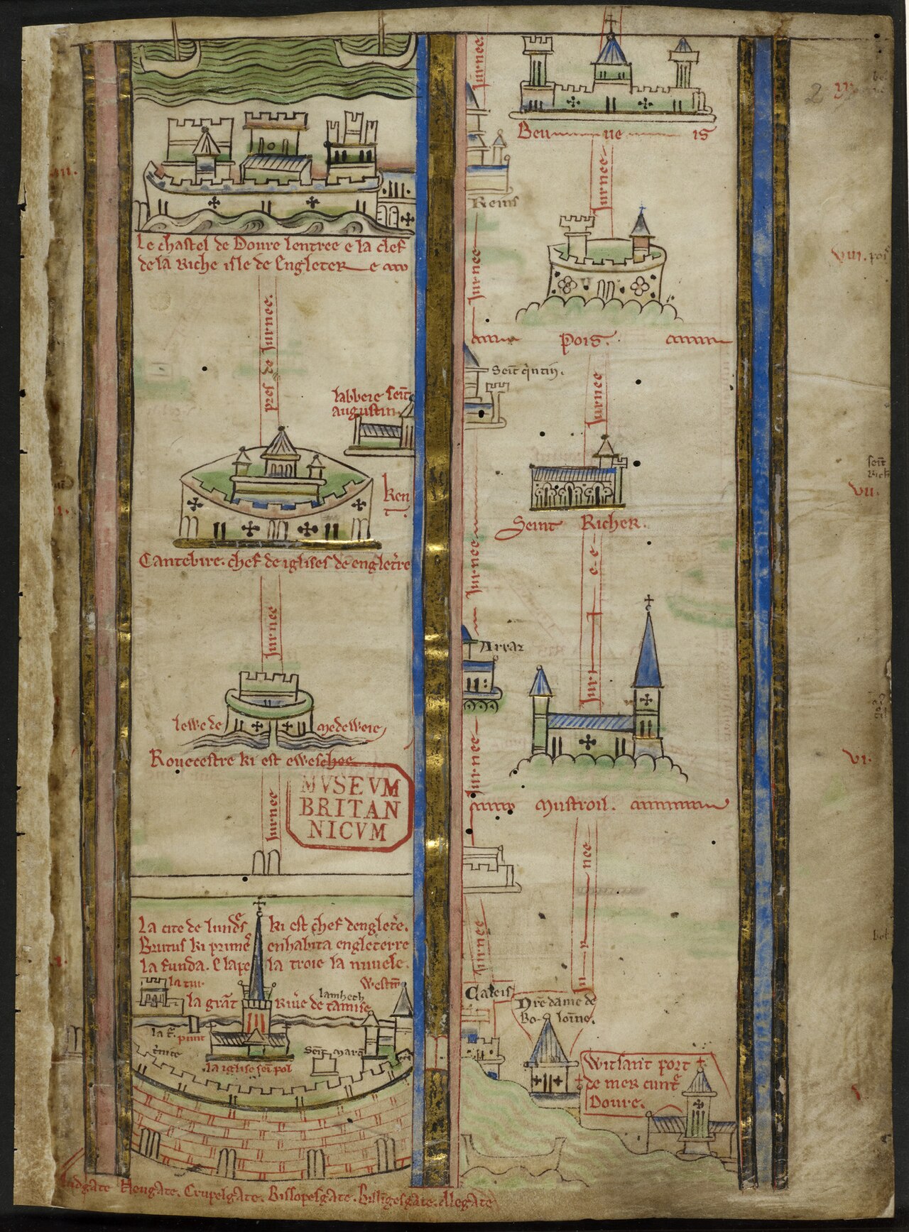
AD 1255 · England to the Holy Land
Matthew Paris turns pilgrimage into a vertical sequence of cities, seas and stations rather than a uniform surface.

AD 1290 · Mediterranean
The oldest surviving portolan - the sea as a web of bearings.
AD 1295 · Novgorod / Riga
A sixty-four-article rule text makes Peterhof’s internal discipline visible without turning the merchant compound into territory.
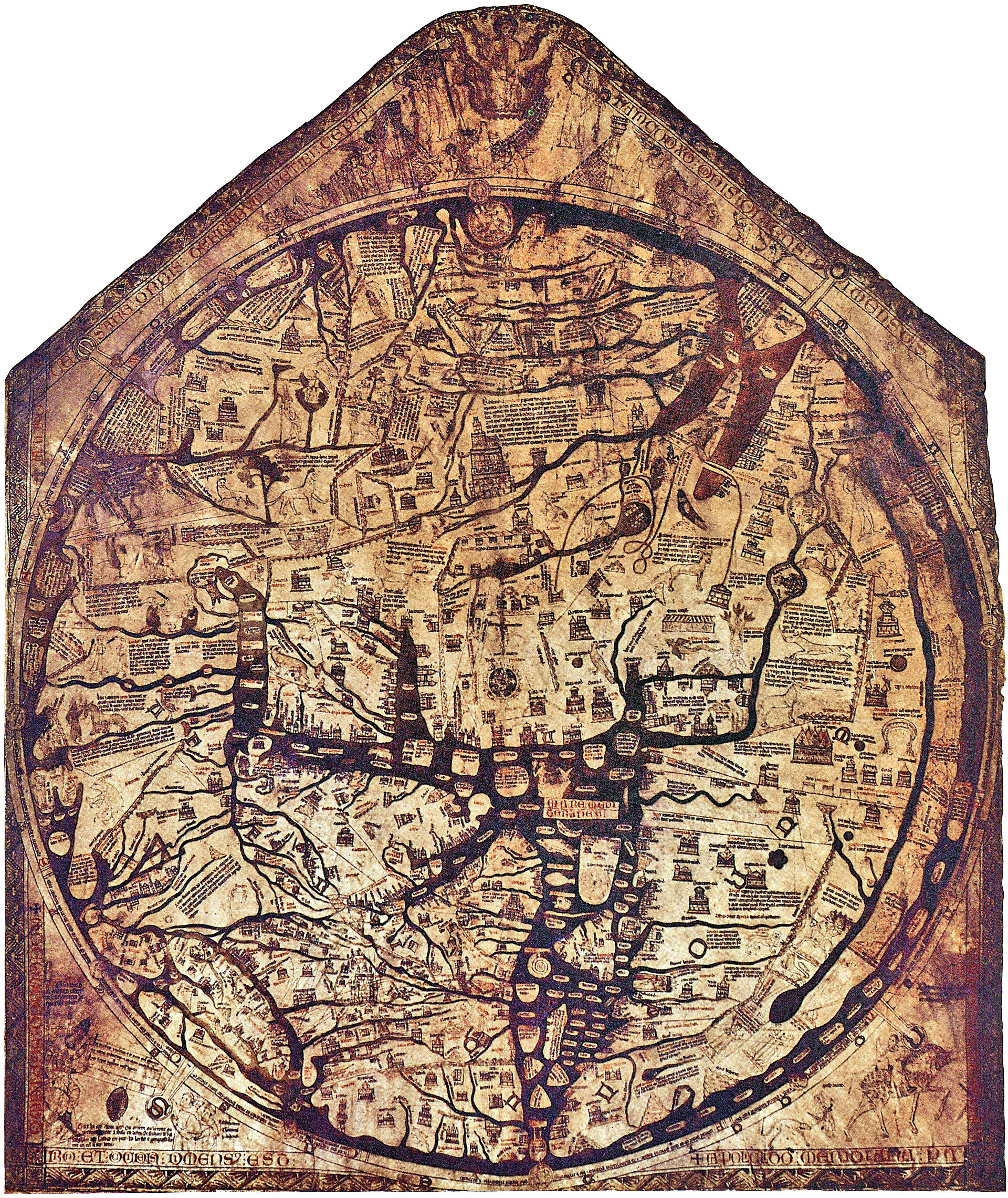
AD 1300 · Hereford
An east-up, encyclopedic Christian world gathered around Jerusalem on a single monumental skin.

AD 1311 · Eastern Mediterranean
Pietro Vesconte’s signed chart presents the eastern Mediterranean as an ordered sequence of coasts and crossings.
%20atlas.jpg?width=1400)
AD 1321 · Western Mediterranean
A western Mediterranean atlas leaf extends Vesconte’s navigational grammar across a second maritime field.

AD 1335 · Mediterranean and Black Seas
An anonymous vellum chart turns the Mediterranean and Black Seas into a continuous field of named coasts and bearings.
AD 1436 · Venice
Andrea Bianco’s atlas binds portolan leaves, tables and cosmographic material into one Venetian working manuscript.
AD 1458 · Bruges
A charter group records building, staple and excise privileges as negotiated access inside a host city.

AD 1459 · Venice
Venice's encyclopaedic world, drawn south-up.
.png?width=1600)
AD 1466 · Mediterranean
Petrus Roselli’s chart preserves the dense coastal names and rhumb network of the Majorcan portolan tradition.

AD 1472 · Augsburg
A small woodcut transmits an inherited tripartite world as a portable printed diagram.
AD 1475 · Lübeck
An incunable combines universal history, genealogical apparatus and printed world maps in one book.
AD 1475 · Lübeck
A world map printed in Lübeck names northern regions but does not draw the commercial institution around its press.
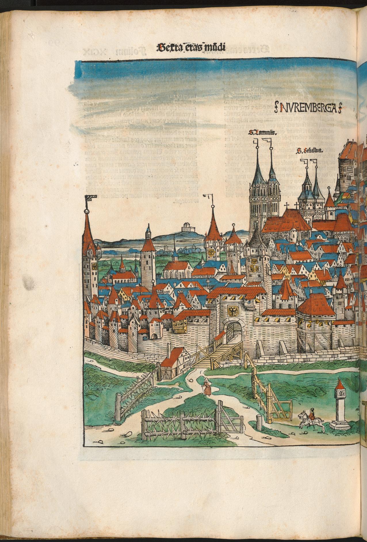
AD 1493 · Nuremberg
A coloured chronicle-page view remembers Nuremberg through wall, gate, church towers and concentrated civic profile.

AD 1500 · Venice
Jacopo de’ Barbari turns the lagoon into an inspectable city while the wider commercial network remains beyond the frame.
AD 1507 · Saint-Dié
The map that first wrote "America".
AD 1532 · Transylvania
A humanist maps his own Carpathian homeland.
AD 1539 · Northern Europe
Olaus Magnus makes the northern seas dense with places, creatures and movement as Hanseatic institutions enter a later phase.
AD 1544 · Venice
Battista Agnese’s workshop joins navigational charts and a world map in a richly illuminated Venetian atlas.

AD 1551 · Rome
Bufalini’s large printed plan joins ancient enclosure, papal Rome and surveyed urban fabric on a continuous surface.
AD 1554 · London
Thirty leaves regulate elections, jurisdiction, finance, conduct and training inside the Steelyard community.
AD 1561 · London
A bird’s-eye woodcut tradition makes early modern London searchable as streets, gates, buildings and river traffic.
AD 1569 · Duisburg
Rhumb lines made straight - navigation bought with area.

AD 1570 · Antwerp
The first documented state of Ortelius’s opening world map, before wear and repair accumulated on its copperplate.
AD 1570 · Antwerp
The first modern atlas - the world bound as a book.

AD 1571 · Antwerp
A high-resolution early impression provides a second witness to the plate before its documented corner repair.
AD 1572 · Cologne and a world of cities
Braun and Hogenberg’s six-volume atlas makes hundreds of urban plans and prospects available as a repeatable comparative genre.

AD 1572 · Antwerp
A 1572 impression keeps the early plate visible across the atlas’s rapid first sequence of language editions.
AD 1575 · Antwerp
Bolt impressions at the lower-left corner record an attempt to stabilise a crack in the working plate.
.jpg?width=1600)
AD 1579 · Antwerp
The repaired crack and reworked clouds make this high-resolution impression the essay’s witness to managed age.

AD 1581 · Magdeburg
Bünting arranges three continents as a Christian emblem whose leaves meet at Jerusalem.
AD 1584 · Antwerp
A newly added date coexists with progressively fading hachuring near the end of the first plate’s working life.

AD 1587 · Antwerp
The short-lived second plate renews the familiar composition while preserving corner clouds and an initial 1586 date.
AD 1588 · Antwerp
A recut South American coastline makes geographic revision visible inside the renewed but familiar plate.
AD 1593 · Lübeck
The engraved city portrait calls Lübeck head of the Wendish cities and the Hanseatic society while presenting an autonomous imperial city.
AD 1593 · Hamburg
A river city is made visible as a civic body while the commercial relationships extending beyond it remain implicit.
AD 1593 · London
The London plate pairs an urban view with a text naming the Steelyard, four Kontore and a confederated society of cities.
AD 1593 · Bruges
A circular city portrait describes Bruges as having once been a flourishing emporium without fixing a single date for decline.
AD 1593 · Cologne
The Rhine city’s plate names a league of seventy-two cities and four principal cities, a claim kept distinct from the four Kontore.
AD 1593 · Bremen
Bremen appears as a river prospect on a sheet whose Lüneburg panel also names the salt economy behind a major corridor.
AD 1613 · Antwerp
A posthumous state adds Le Maire Strait and removes the old date while retaining the Ortelian world-map identity.
AD 1633 · Bergen
Nine court books record internal jurisdiction, fees, fire safety, office holders and price lists across Bryggen’s long afterlife.

AD 1739 · Paris
Twenty sectional plates assemble an oblique, building-by-building performance of eighteenth-century Paris.
AD 1744 · France
Triangulation turns a kingdom into a survey.
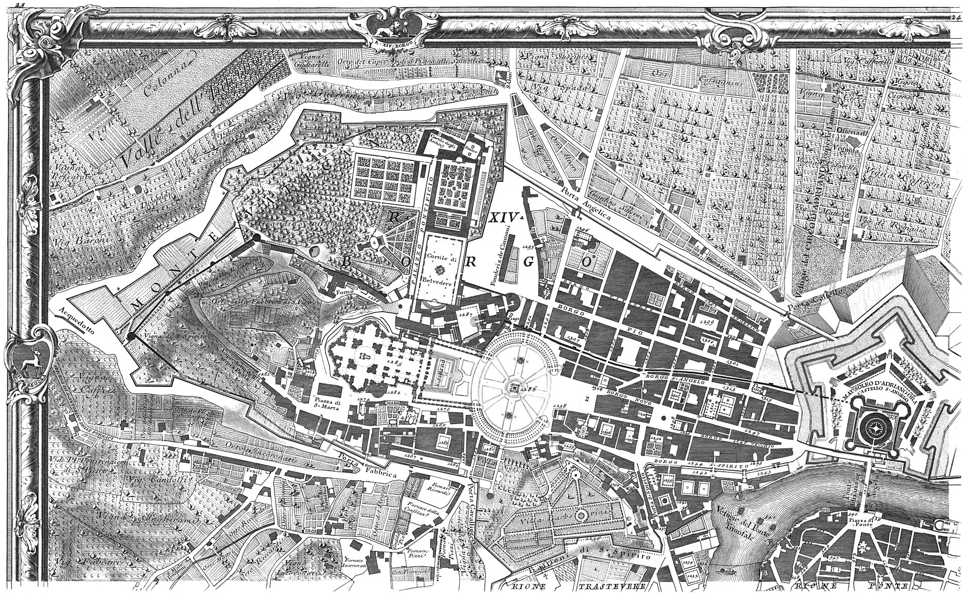
AD 1748 · Rome
Nolli’s ichnographic plan joins streets and accessible interiors in a white field whose public-private grammar remains inspectable.
AD 1791 · Romania
Habsburg military survey turns territory into administered grid.
AD 1899 · Buffalo
A 110-sheet insurance volume remembers blocks as materials, uses and hazards selected for commercial risk assessment.
AD 1972 · Global
Earth seen whole, from outside - the photographic map.
No maps match those filters.