AD 1255 · 13th century · England to the Holy Land
Itinerary from London toward Jerusalem
Matthew Paris turns pilgrimage into a vertical sequence of cities, seas and stations rather than a uniform surface.
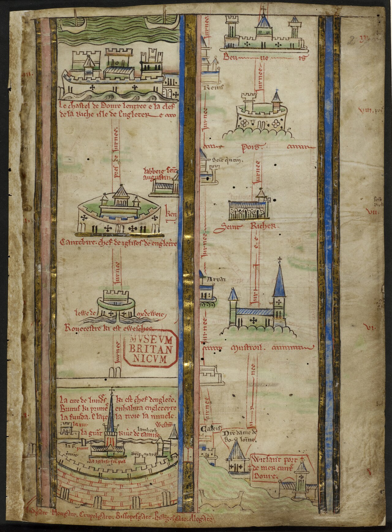
Catalogue record
| Cartographer | Matthew Paris |
|---|---|
| Medium | Ink and pigments on parchment |
| Repository | British Library, London |
| Repository ID | Royal MS 14 C VII |
| Custody | Held by the repository named above |
Open questions
Looked at and unresolved. Listed so the gap reads as a question somebody asked rather than a field nobody reached.
- state
- Which folios carry the itinerary in this witness is recorded here as fol. 2 and has not been checked against the manuscript; the Crusades source audit carries the same volume with its locator still marked pending. The British Library catalogue entry and digitised foliation for Royal MS 14 C VII, which would settle the locator for both records at once.
- attribution
- Matthew Paris left more than one itinerary copy, and the Corpus Christi College manuscripts carry versions that differ from this one. Which witness this record should stand on is a choice the essay has not yet had to make. Collation of Royal MS 14 C VII against CCCC MS 26 and CCCC MS 16, both already registered in the Crusades source audit.
Tags
- itinerary
- pilgrimage
- Jerusalem
- route
- manuscript
Related essays
Related maps
- Madaba mosaic map, Jerusalem detail · AD 570
- Hereford Mappa Mundi · AD 1300
Bibliography
- British Library. Royal MS 14 C VII, Matthew Paris, Historia Anglorum and prefatory itinerary materials. Archives and Manuscripts Catalogue.
- Edson, Evelyn. Mapping Time and Space: How Medieval Mapmakers Viewed Their World. London: British Library, 1997.