
The Border · The Archive · The Map · AD 106–1974
Nomen Errans
A name is not a thing. It is a job, and the same word can be given several.
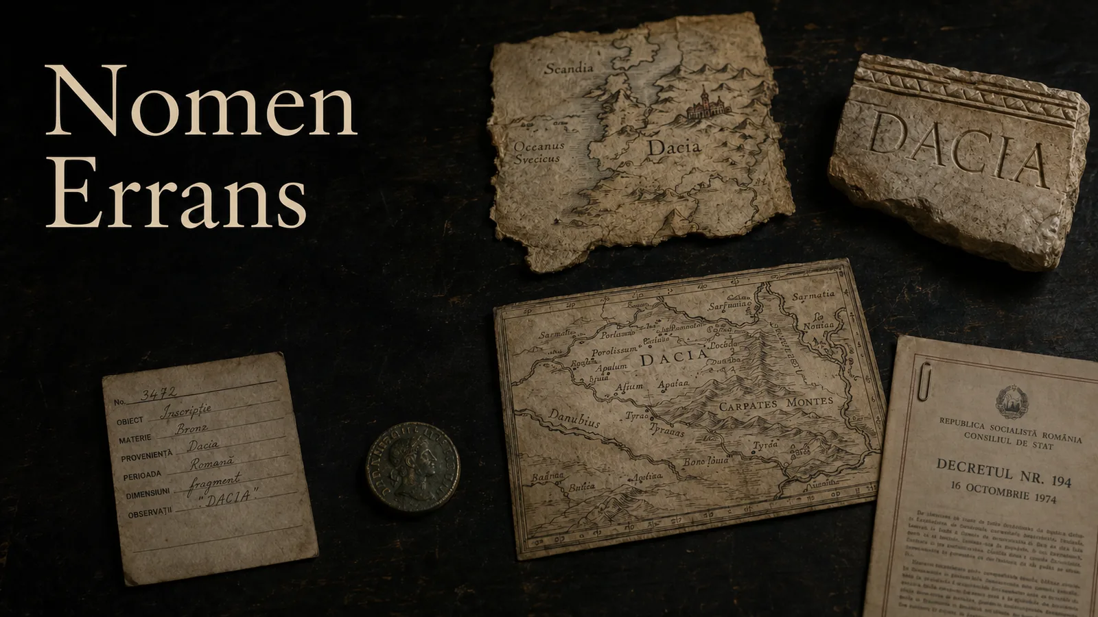
Dacia can name a Roman province north of the Danube. It can name a later province south of it, a civil diocese, a figure on imperial coinage, the Scandinavian north on a medieval world map, or a province restored by an antiquarian more than a millennium after Roman administration withdrew. The letters remain remarkably stable. The thing indicated by them does not.
That instability creates a familiar cartographic temptation. Put the uses in date order, place them on one map, and the eye will invent a journey: the name appears to flow from one territory into the next. But chronological adjacency is not transmission, a shared spelling is not continuity, and a map that connects every node would make a stronger historical claim than the surviving evidence allows.
This essay follows a stricter route. Each public career comes from a reviewed row in the Corpus Nominum Daciae. Each row states who used the word, what it referred to, when, on which source, at what locator and with what confidence. The map opens only where a compiled Atlas layer honestly covers that referent. A line between careers appears only when the relationship itself has passed review. An empty space is therefore not unfinished design. It is the visible form of a claim the evidence has not earned.
Read this beside Terra Sigillata, which asks how maps and catalogues name the ground. Nomen Errans asks the inverse question: what happens when the name leaves that ground behind?
 The Archive
 Historical geography often begins with a proper noun and quietly treats it as a stable key. A place record called Dacia seems to promise that every occurrence of the word can be joined to the same object. That is convenient for a database and dangerous for an argument.
The corpus separates three things that prose too easily collapses. The lexical form is the written word. The referent is what a particular use makes the word indicate. The relationship is an evidenced claim about how two uses are connected. Repeating the first does not establish either of the other two.
This distinction matters even inside Roman administration. The Trajanic province, the later Dacia south of the Danube and the dioecesis Daciae are not three dates for one stable polygon. They are different administrative objects. The coin legend is another kind of use again: a mint makes the name circulate without supplying a boundary. Ptolemy’s coordinate catalogue, Eutropius’s narrative, the Notitia Dignitatum and the imperial coin series answer different questions. The ledger keeps their source families because their silences differ as much as their words.
The release page does not copy their chronology into prose. The panels below are compiled from the same tables as the data release. Correcting a date or locator in the corpus changes the essay on the next deterministic build; demoting a row below review removes it from the public sequence. The text cannot preserve an older, more confident version by accident.
 The Map
 Each step is one reviewed use. The fate class names the operation performed on the word: applicatio applies it to an administrative or representational referent; translatio carries it to different ground; restitutio deliberately restores an earlier name. These labels classify what the source does. They do not claim a genealogy between sources.
Applicatio The name is applied to a new administrative or institutional entity.
Dacia, DACIA as a personification struck on imperial coinage
Region · The imperial mint
- Period
- 106–271 (year range)
- Source
- Roman Imperial Coinage (London, 1923-2019); the Dacia types cited here are in vol. II.3, ed. R. A. Abdy and P. F. Mittag (2019), Hadrian 1648-1663
- Locator
- RIC II.3, Hadrian 1648-1663: reverse types legended DACIA (section)
- Confidence
- Medium Supported, but through a chain the editor has not closed to the witness.
The state naming its own province on the money, which is the use with the widest circulation and the shortest text. Hadrian's province series is the reviewed reading; no specimen has been examined, so the row cites the catalogue rather than a coin.
Applicatio The name is applied to a new administrative or institutional entity.
Dacia, Trajanic province north of the Danube
Region · Roman imperial administration
- Period
- 106–271 (year range)
- Source
- Ptolemy, Geographia III.8
- Locator
- Geographia III.8 (section)
- Confidence
- Medium Supported, but through a chain the editor has not closed to the witness.
The province Trajan made in 106. Ptolemy's book and chapter are the locator; the chapter has not been read against a witness for this corpus.
Applicatio The name is applied to a new administrative or institutional entity.
Dacia, Dacia Aureliana south of the Danube
Polity · Roman imperial administration
- Period
- from 271 (terminus post quem)
- Source
- Eutropius, Breviarium ab urbe condita, ed. C. Santini (Leipzig, 1979)
- Locator
- Breviarium 9.15 (section)
- Confidence
- Medium Supported, but through a chain the editor has not closed to the witness.
After Aurelian withdrew, the name was carried south of the Danube and applied to a new province. Eutropius narrates the act, which is what this row records; the Notitia attests the name in official use a century later and is cited by nmu-dacia-diocese instead.
No layer compiled. Dacia Aureliana lies south of the Danube and no compiled layer covers it. A link to the Trajanic baseline would show the reader the wrong province under the right word.
Applicatio The name is applied to a new administrative or institutional entity.
Dacia, Dioecesis Daciae, the civil diocese south of the Danube
Region · Praetorian prefecture of Illyricum
- Period
- 337–602 (year range)
- Source
- Notitia Dignitatum, ed. O. Seeck (Berlin, 1876)
- Locator
- Oriens: dioecesis Daciae (section)
- Confidence
- Medium Supported, but through a chain the editor has not closed to the witness.
A different administrative level from the province of the same name, and the clearest case that the referent is not the word: one Dacia contains the other, and neither is Trajan's.
No layer compiled. The civil diocese is a different administrative level from the province and has no compiled geometry. Drawing it as the province would collapse the distinction this use exists to record.
Translatio The name is carried to a different referent.
Dacia, Denmark and the Scandinavian north
Region · Latin geographical usage
- Period
- c. 1300 (circa)
- Source
- Hereford Mappa Mundi
- Locator
- The map carries no folio or sheet division; the single membrane is the maximum precision available (whole work)
- Confidence
- Medium Supported, but through a chain the editor has not closed to the witness.
Medieval Latin writers used Dacia for Denmark, and the Hereford map is one witness to the usage. This is the coincidence the trench exists to adjudicate.
Outside the Atlas. Denmark and the Scandinavian north lie outside the extent of every Dacia layer. This is the trench's argument rather than a gap in the Atlas: the word left the ground the map covers.
Restitutio The name is restored to a referent it had formerly held.
Dacia, The ancient province restored on a modern sheet
Region · Antiquarian scholarship
- Period
- 1595 (exact year)
- Source
- Ortelius, Parergon, 1595
- Locator
- Parergon: Daciarum Moesiarumque vetus descriptio (sheet)
- Confidence
- Medium Supported, but through a chain the editor has not closed to the witness.
Ortelius restores the ancient province in the historical supplement to the Theatrum. The sheet is named; the impression has not been examined.
Read the ledger as a table
| Period | Referent | Fate | Source and locator | Confidence |
|---|---|---|---|---|
| 106–271 | DACIA as a personification struck on imperial coinage | Applicatio | Roman Imperial Coinage (London, 1923-2019); the Dacia types cited here are in vol. II.3, ed. R. A. Abdy and P. F. Mittag (2019), Hadrian 1648-1663 - RIC II.3, Hadrian 1648-1663: reverse types legended DACIA | Medium |
| 106–271 | Trajanic province north of the Danube | Applicatio | Ptolemy, Geographia III.8 - Geographia III.8 | Medium |
| from 271 | Dacia Aureliana south of the Danube | Applicatio | Eutropius, Breviarium ab urbe condita, ed. C. Santini (Leipzig, 1979) - Breviarium 9.15 | Medium |
| 337–602 | Dioecesis Daciae, the civil diocese south of the Danube | Applicatio | Notitia Dignitatum, ed. O. Seeck (Berlin, 1876) - Oriens: dioecesis Daciae | Medium |
| c. 1300 | Denmark and the Scandinavian north | Translatio | Hereford Mappa Mundi - The map carries no folio or sheet division; the single membrane is the maximum precision available | Medium |
| 1595 | The ancient province restored on a modern sheet | Restitutio | Ortelius, Parergon, 1595 - Parergon: Daciarum Moesiarumque vetus descriptio | Medium |
5 further uses are compiled and not shown, because nobody has cleared them yet: The Scandinavian province represented at the Dominican general chapter (normalized); Dacia Porolissensis made to support a Romanian historical-continuity claim (normalized); Transalpina / Havasalfevlde, the territory south-east of Transylvania, glossed with the ancient name (normalized); Contemporary Transylvania, glossed with the ancient province name (normalized); Contemporary Transylvania, equated with Pannodacia and Dacia Ripensis (normalized).
The medieval step is the fracture that makes the method necessary. On the Hereford Mappa Mundi, around 1300, Dacia belongs to the Scandinavian north. The source is one membrane and therefore has no page or sheet number to pretend to precision; the whole work is the locator. Its reviewed row says what the map calls the region. It does not say that Denmark descends from the Roman province, that the name moved there by one recoverable route, or that a medieval reader understood every earlier career gathered on this page.
The early-modern return is different again. Ortelius’s Daciarum Moesiarumque vetus descriptio belongs to the Parergon, the historical supplement to the Theatrum. Its Dacia is an antiquarian reconstruction: an ancient province made present on a printed sheet through a Renaissance reading of old authorities. The fate class is therefore restitutio, not continuity. The map’s date tells us when Ortelius restored the province to view, not that the province had persisted until 1595.
The source apparatus beneath the panels is as important as the sequence above them. A repository, citation and locator let a reader ask whether a row says only what its witness can support. Confidence is spelled out rather than encoded by colour. Careers without an honest Atlas layer say so instead of opening the nearest available geometry and hoping proximity will be mistaken for evidence.
The diagram below makes the problem deliberately uncomfortable. It has reviewed nodes, a chronological direction, and relationship lines that had to be earned one at a time. Every line is a derivation, a revival, or - drawn dashed - an explicit homonym only: two careers that share a string and nothing else. Not one asserts continuity, because the schema will not let a continuity edge exist without an attestation to carry it, and none has been cited. Other relationships have passed review and are still not drawn, because they land on a use that has not; a reviewed edge is never permission to draw a line to a referent nobody has cleared. Chronological order alone draws nothing at all.
Reviewed uses only
The word moves; the evidence decides whether a line follows
6 states · 8 reviewed relations
compiled layer evidence selected feature
Mapped from compiled Atlas layers
DACIA as a personification struck on imperial coinage
The referent is the province, so the province is what the Atlas opens on. The coin itself is a witness with no findspot in this corpus and is not on the map.
Layers: Roman Dacia · principal sites
- Period
- 106–271
- Fate
- Applicatio - The name is applied to a new administrative or institutional entity.
- Source
- Roman Imperial Coinage (London, 1923-2019); the Dacia types cited here are in vol. II.3, ed. R. A. Abdy and P. F. Mittag (2019), Hadrian 1648-1663
- Locator
- RIC II.3, Hadrian 1648-1663: reverse types legended DACIA
- Confidence
- Medium - Supported, but through a chain the editor has not closed to the witness.
- Relationship
- Derivation: The mint strikes the name of the province the same administration had just made.
Mapped from compiled Atlas layers
Trajanic province north of the Danube
The Trajanic province is the one career of the word the Atlas already draws, as sites and as the road and frontier network compiled for KAN-341.
Layers: Roman Dacia · principal sites · Roman Dacia · roads and frontier corridors
- Period
- 106–271
- Fate
- Applicatio - The name is applied to a new administrative or institutional entity.
- Source
- Ptolemy, Geographia III.8
- Locator
- Geographia III.8
- Confidence
- Medium - Supported, but through a chain the editor has not closed to the witness.
- Relationship
- No reviewed relationship line reaches this state.
No compiled geometry
Dacia Aureliana south of the Danube
Dacia Aureliana lies south of the Danube and no compiled layer covers it. A link to the Trajanic baseline would show the reader the wrong province under the right word.
- Period
- from 271
- Fate
- Applicatio - The name is applied to a new administrative or institutional entity.
- Source
- Eutropius, Breviarium ab urbe condita, ed. C. Santini (Leipzig, 1979)
- Locator
- Breviarium 9.15
- Confidence
- Medium - Supported, but through a chain the editor has not closed to the witness.
- Relationship
- Derivation: The later province is named after the abandoned one by the same administration.
No compiled geometry
Dioecesis Daciae, the civil diocese south of the Danube
The civil diocese is a different administrative level from the province and has no compiled geometry. Drawing it as the province would collapse the distinction this use exists to record.
- Period
- 337–602
- Fate
- Applicatio - The name is applied to a new administrative or institutional entity.
- Source
- Notitia Dignitatum, ed. O. Seeck (Berlin, 1876)
- Locator
- Oriens: dioecesis Daciae
- Confidence
- Medium - Supported, but through a chain the editor has not closed to the witness.
- Relationship
- Derivation: The diocese is the administrative container of the Danubian provinces that carry the name. · Derivation: The diocese south of the Danube is named from the province north of it by the same administration.
Mapped from compiled Atlas layers
The ancient province restored on a modern sheet
Ortelius's readings are in the corpus, so the Atlas can open on the reconstruction itself rather than on the province it reconstructs.
Layers: Dacia name attestations (research tier, unreviewed)
- Period
- 1595
- Fate
- Restitutio - The name is restored to a referent it had formerly held.
- Source
- Ortelius, Parergon, 1595
- Locator
- Parergon: Daciarum Moesiarumque vetus descriptio
- Confidence
- Medium - Supported, but through a chain the editor has not closed to the witness.
- Relationship
- Revival: Ortelius restores the ancient province from the authors in the Parergon of 1595.
Directed-flow diagram
Same word, separately reviewed referents
8 lines cleared
Every line above resolves to a human-reviewed relationship row. Dashed lines mean “homonym only”, an explicit non-relationship.
Some careers can still open useful map states. The Trajanic province opens the Roman sites and network at AD 150. The coin legend opens the province it names, not a guessed findspot for an unspecified coin. Ortelius opens the research-tier attestation that records the reconstruction. Every link carries the essay slug, so the Atlas can return the reader to this passage rather than dropping them at a generic catalogue.
Other careers correctly open nothing. The southern province and the civil diocese have no compiled geometry. Pointing either at the Trajanic layer would turn the same word into the same territory. Scandinavia is outside the extent of every Dacia layer; that absence is the essay’s finding, not a missing feature request.
The result is a map that distinguishes three answers: mapped, not compiled and outside coverage. Most digital maps offer only present or absent. Here the reason for absence carries the argument, because an unbuilt layer and an irrelevant extent are not the same epistemic state.
Historical-map rights do not follow automatically from the age of the work. The ledger assessed six candidate witnesses. The Hereford Mappa Mundi photograph needs permission; the Tabula Peutingeriana digitisation, an Ortelius impression and a coin specimen need object-level rights review; the exact Notitia page remains unlocated. They stay research-only, so this essay describes them and reproduces none of their images.
One later document clears the production bar. Decree no. 194 of 16 October 1974 survives on page 1 of the Romanian official bulletin. The scan is sufficient, its object identity is fixed, and the source page records the official text and its document photograph as exempt from Romanian copyright protection. The operative article adds Napoca to Cluj. That makes it a useful boundary object for this essay: rights permit the page to be shown, but the two name-use readings attached to it remain normalized rather than human-reviewed, so neither is promoted into the career sequence above.

Decretul Consiliului de Stat nr. 194/1974, Buletinul Oficial al R.S. România, anul X, partea I, nr. 125, p. 1. Official-text scan, PD-RO-exempt / no known restrictions, via Wikimedia Commons. The image is source-checked; its normalized name-use rows remain withheld pending a named human review.
That asymmetry is deliberate. Reuse permission answers whether the page may be shown. Scholarly review answers what claims the publication is prepared to make from it. A permissive licence cannot promote an interpretation, and an excellent interpretation cannot supply image rights. The two gates meet only at release.
The wandering in Nomen Errans is not a biography of a word with every missing year filled. It is a record of distinct, inspectable employments. Between them lie gaps in evidence, changes of institution, shifts of medium and, in the Scandinavian case, different ground altogether.
This changes what an atlas can responsibly do. It can compare referents without merging them. It can direct a reader from a reviewed use to a relevant layer and back. It can expose the reason a layer is absent. It can record a candidate relationship without drawing it. What it cannot do is make sameness of spelling stand in for sameness of territory, people or authority.
The most consequential mark in the diagram is therefore the one line it does not draw: the unbroken path from Trajan’s province through every later Dacia. No edge in the ledger is a continuity, because continuity has to cite an attestation and not one does. A continuous path would be visually satisfying and historically premature. Its absence makes a smaller claim than the lines around it, but a more useful one: every connection in an atlas should be able to say who reviewed it, what source supports it and what kind of relationship it asserts.
Continue through The Border, inspect naming as an archival problem in The Archive, or return to
Terra Sigillata for the longer history of how Dacia was measured, depicted and withheld.
Sources and evidence
Ptolemy, Geographia III.8.
Eutropius, Breviarium ab urbe condita 9.15.
Notitia Dignitatum, Oriens, dioecesis Daciae; edition of Otto Seeck, Berlin, 1876.
Roman Imperial Coinage II.3, Hadrian 1648–1663: the province series, reverse types legended DACIA.
- Hereford Mappa Mundi, single membrane, Hereford Cathedral, c. 1300.
Abraham Ortelius, Daciarum Moesiarumque vetus descriptio, Parergon, 1595.
Constitutiones Ordinis Fratrum Praedicatorum, Paris general chapter, 1228, transcribed in the Diplomatarium OP Dacie.
Decretul Consiliului de Stat nr. 194/1974, Buletinul Oficial al R.S. România, anul X, partea I, nr. 125, 18 October 1974, p. 1;
source and rights record
.
The public panels and Atlas links are compiled from reviewed CND rows. The source list also names the normalized 1228 and 1974 boundary records so their withheld status can be inspected rather than hidden.