
Room 6 of 7
The Archive
History, memory, and archaeology - maps as artefacts and the silences they keep.
Every map eventually stops describing the world and starts describing the moment that made it. The Archive is the room where cartography becomes artefact - the old sheet read not for its accuracy but for its assumptions, its omissions, the vanished certainties it preserves in ink. It asks what a map becomes once it is old: a record, a relic, a piece of evidence to be excavated like any other stratum. Here mapping meets history and archaeology, and the silences matter as much as the marks - the territories left blank, the peoples uncounted, the knowledge that never made it onto the page. To read the archive against the grain is to treat absence as data. We ask not only what these maps once claimed to show, but what they were built, quietly, to keep from view.
The room's anchor
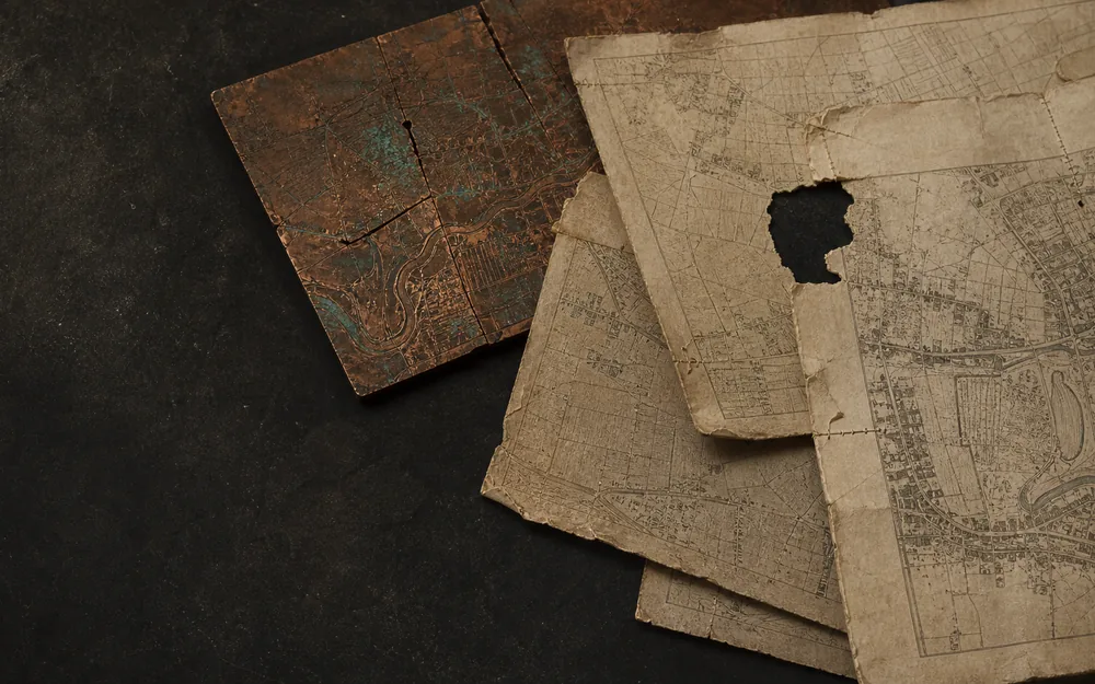
Maps That Age
The Copperplate Remembers
A map can keep its title while its plate cracks, fades, is repaired, recut and corrected. Nine Ortelius impressions reveal age as an editorial history, not a date.
Essays that pass through
Chapters in this room
- Below the wall, the trench in Terra Sigillata · Lapidarium Dacicum
- Section comparison in Terra Sigillata · Lapidarium Dacicum
- The evidence up close in La Rotta e il Catasto
- A plate is not a file in Maps That Age
- Wear writes itself in Maps That Age
- The archive makes age in Maps That Age
- Print remembers the diagram in Invisible Maps of Religion
- The city survives as a fragment in Cities Remember
- Risk remembers the block in Cities Remember
- The witness at the release boundary in Nomen Errans
- The charter is a map in The League That Left No Map
- The lapidarium, stone by stone in Terra Sigillata · Lapidarium Dacicum
- The double-entry of two worldviews in La Rotta e il Catasto
- Correction without rupture in Maps That Age
- The fiction of the edition in Maps That Age
- What measurement can and cannot say in Maps That Age
- The world as simultaneous history in Invisible Maps of Religion
- Walls after walls in Cities Remember
- An overlay is an argument in Cities Remember
- The Earth refuses stillness in The Shape of a Civilization
- A word is not a territory in Nomen Errans
- The careers of the word in Nomen Errans
- The lines a sequence earns in Nomen Errans
- What a name can and cannot prove in Nomen Errans
- Remove the network in The League That Left No Map
- Merchants before the League in The League That Left No Map
- Four cities inside other cities in The League That Left No Map
- Power without sovereignty in The League That Left No Map
- A sea between cities in The League That Left No Map
Atlas layers
- Roman Empire, AD 117 Imperial extent at Trajan's greatest reach - context for the Dacia essay.
- Hanseatic places and participation phases Sixty source-linked city, market and Kontor phases with historical and modern names and explicit participation classes.
- Hanseatic institutional events Privileges, ordinances, embargoes, conflict, treaties, Hansetage, Kontor closures and institutional afterlives.
- Dacia name attestations (reviewed) Where a source does or does not name a place in the Dacia corpus. This layer carries only records cleared by human review, and is empty until that review happens.
- Dacia name attestations (research tier, unreviewed) The full CND 1.0 release candidate: every compiled attestation including silences and normalized imports, none of it cleared by human review. Records here may not be cited as established evidence.
- Roman Dacia · principal sites Legionary fortresses, road stations and mining centres of the province. Every point is the corpus's own reference location for that place, carrying the corpus's provenance: none is an excavated centroid.
- Josephinian survey · sheet index Where the First Military Survey of Transylvania, 1769-1773, covers the corpus. Each footprint links to the repository that holds the sheet; no scan is served from here, and the footprints are reconstructed rather than taken from the archive index.
- Ghost geographies (contract only, no positions located) Features claimed, mapped and later removed, held with their original evidence rather than as a list of mistakes. The layer is currently empty: five ghost features are recorded and not one of their disputed positions has been located, so none carries geometry.
- Matthew Paris itinerary: stages at modern positions (unreviewed) Fourteen stages of the drawn road from London to Otranto, placed at the modern coordinates of the towns they name. The manuscript gives no coordinates at all, so the positions are reference context and the labels and day-marks are the evidence.
Collection sheets
-
 Saint-Sever Beatus world map An east-up world in an Apocalypse commentary joins geography to apostolic and sacred history.
 -
 Ebstorf world map Known through photographs and facsimiles, the monumental world was figured within the body of Christ.
 -
 T–O map in the first printed Etymologiae A small woodcut transmits an inherited tripartite world as a portable printed diagram.
 - World map in the Rudimentum Novitiorum An incunable combines universal history, genealogical apparatus and printed world maps in one book.
-
 The world in a clover leaf Bünting arranges three continents as a Christian emblem whose leaves meet at Jerusalem.
 - Forma Urbis Romae The Severan marble plan survives in 1,186 known fragments, turning the mapped city into an evidence problem of joins, proposed locations and absences.
-
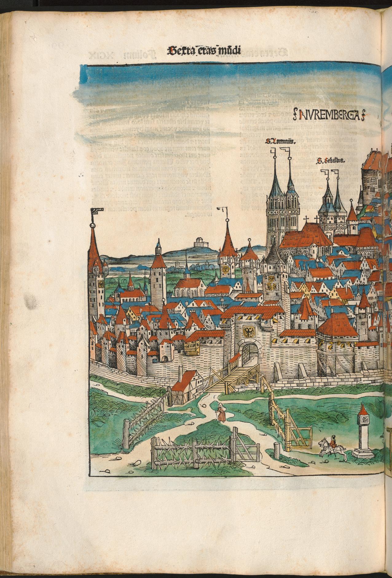 Nuremberg in the Liber Chronicarum A coloured chronicle-page view remembers Nuremberg through wall, gate, church towers and concentrated civic profile.
 -
 Pianta di Roma Bufalini’s large printed plan joins ancient enclosure, papal Rome and surveyed urban fabric on a continuous surface.
 - Civitas Londinum (the Agas map) A bird’s-eye woodcut tradition makes early modern London searchable as streets, gates, buildings and river traffic.
- Civitates Orbis Terrarum Braun and Hogenberg’s six-volume atlas makes hundreds of urban plans and prospects available as a repeatable comparative genre.
-
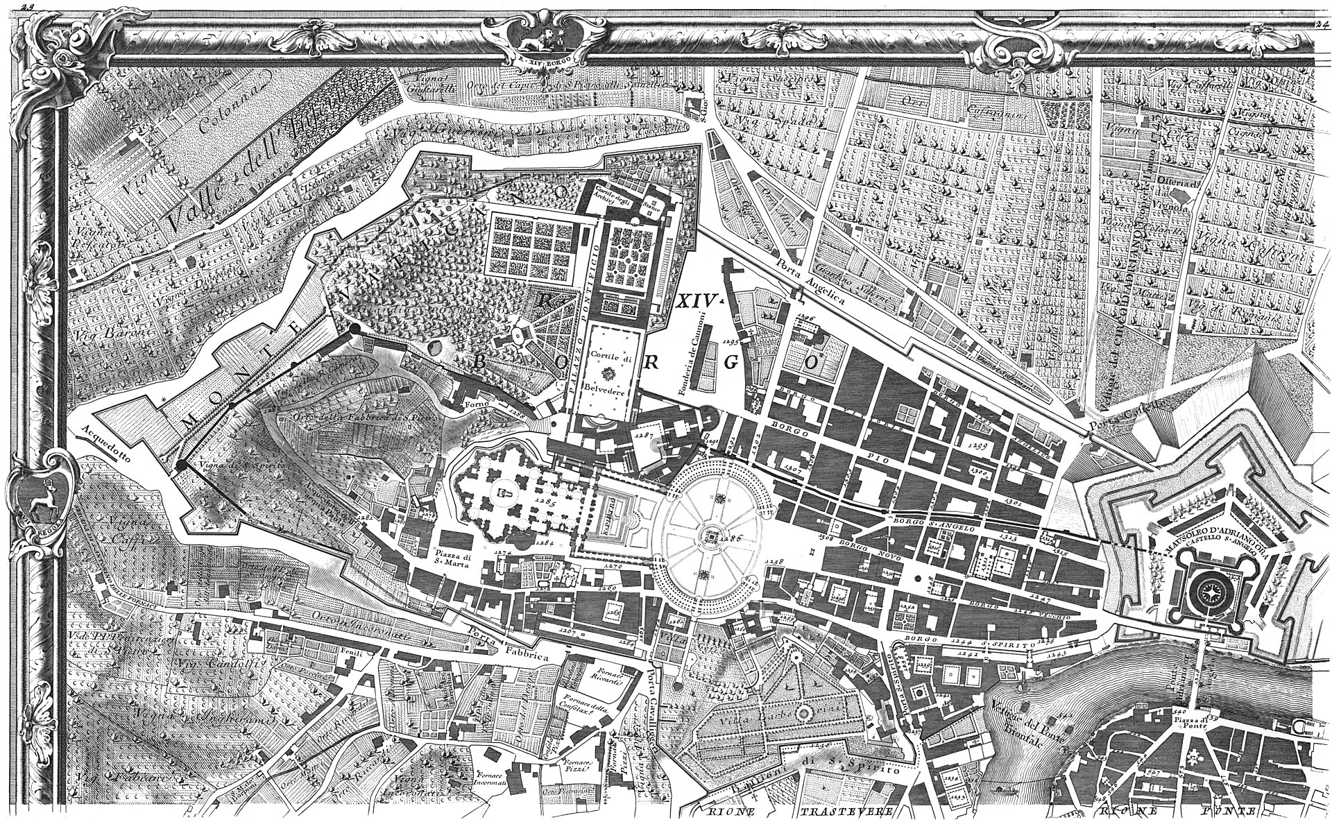 Nuova Pianta di Roma Nolli’s ichnographic plan joins streets and accessible interiors in a white field whose public-private grammar remains inspectable.
 - Sanborn fire insurance map of Buffalo, volume 1 A 110-sheet insurance volume remembers blocks as materials, uses and hazards selected for commercial risk assessment.
-
 Typus Orbis Terrarum, plate 1, state 1.1 The first documented state of Ortelius’s opening world map, before wear and repair accumulated on its copperplate.
 -
 Typus Orbis Terrarum, plate 1, early impression A high-resolution early impression provides a second witness to the plate before its documented corner repair.
 -
 Typus Orbis Terrarum, plate 1, 1572 impression A 1572 impression keeps the early plate visible across the atlas’s rapid first sequence of language editions.
 - Typus Orbis Terrarum, plate 1, state 1.3 Bolt impressions at the lower-left corner record an attempt to stabilise a crack in the working plate.
-
.jpg?width=1600) Typus Orbis Terrarum, plate 1, state 1.4 The repaired crack and reworked clouds make this high-resolution impression the essay’s witness to managed age.
Typus Orbis Terrarum, plate 1, state 1.4 The repaired crack and reworked clouds make this high-resolution impression the essay’s witness to managed age. - Typus Orbis Terrarum, plate 1, state 1.5 A newly added date coexists with progressively fading hachuring near the end of the first plate’s working life.
-
 Typus Orbis Terrarum, plate 2, state 2.1 The short-lived second plate renews the familiar composition while preserving corner clouds and an initial 1586 date.
 - Typus Orbis Terrarum, plate 2, state 2.3 A recut South American coastline makes geographic revision visible inside the renewed but familiar plate.
- Typus Orbis Terrarum, plate 3, state 3.2 A posthumous state adds Le Maire Strait and removes the old date while retaining the Ortelian world-map identity.
- Rudimentum Novitiorum world map, Lübeck copy witness A world map printed in Lübeck names northern regions but does not draw the commercial institution around its press.
- Lübeck, from Civitates Orbis Terrarum, volume I The engraved city portrait calls Lübeck head of the Wendish cities and the Hanseatic society while presenting an autonomous imperial city.
- London and the Stilliards, from Civitates Orbis Terrarum The London plate pairs an urban view with a text naming the Steelyard, four Kontore and a confederated society of cities.
- Bruges, from Civitates Orbis Terrarum, volume I A circular city portrait describes Bruges as having once been a flourishing emporium without fixing a single date for decline.
- Cologne, from Civitates Orbis Terrarum, volume I The Rhine city’s plate names a league of seventy-two cities and four principal cities, a claim kept distinct from the four Kontore.
- Second Novgorod Schra, Riga copy A sixty-four-article rule text makes Peterhof’s internal discipline visible without turning the merchant compound into territory.
- Bergen Kontor court books, 1633–1759 Nine court books record internal jurisdiction, fees, fire safety, office holders and price lists across Bryggen’s long afterlife.
- London Kontor by-laws, 1554 Thirty leaves regulate elections, jurisdiction, finance, conduct and training inside the Steelyard community.
- Bruges privilege charters, 1458–1502 A charter group records building, staple and excise privileges as negotiated access inside a host city.