
The Road · The City · The Archive · AD 1150–1764
Read beside La Rotta e il Catasto and Cities Remember.
The League That Left No Map
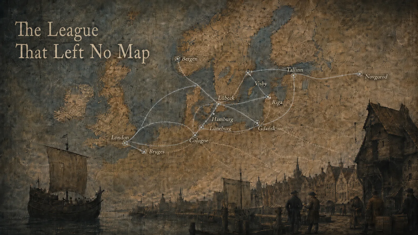
The Hansa connected half a continent, but possessed no shape that a map could easily hold.
Draw northern Europe in the later Middle Ages and one temptation arrives before the ink is dry. Give the Hanseatic League a colour. Fill the towns that appear in a modern list, join them with lines, and let the resulting web stand for a political body. The picture will be immediately recognisable. It will also be too certain in almost every way that matters.
The Hanse was not a kingdom with a stable frontier, a republic with one sovereign council, or a corporation with a surviving roll of members. It gathered merchants, towns, regional groupings, assemblies, overseas establishments, treaties, privileges and habits of cooperation that changed over centuries. A city could attend one Diet and not another. Merchants from a town could trade within the network without establishing a constitutional status that a modern database can safely call membership. A Kontor could exercise serious internal discipline while remaining inside the law and political authority of London, Bergen, Bruges or Novgorod. The vocabulary of a modern political map - border, capital, province, colony - therefore hides the mechanism it claims to reveal.
This essay begins elsewhere: with witnesses that show cities, seas and documents but do not show a single Hanseatic territory. It treats absence as evidence of a mismatch between institution and cartographic form, not as proof that contemporaries failed to understand their commercial world. The maps knew how to depict the world they were made to depict. The problem is ours when we ask one image to perform the work of a privilege charter, an ordinance, a merchant oath, a city view and a route history at once.
The interactive diagrams below are modern analytical reconstructions built from the published HSE datasets. Their lines are generalized relationships between documented nodes. Their dates are evidence windows, not a concealed membership list. Their commodity filters record qualitative associations, not cargo quantities. Whenever the historical sources support less certainty than the screen can display, the text and legend keep that limitation visible.
 The Archive
  The Theatre
 Open the Rudimentum Novitiorum at folios 85 verso and 86 recto. Printed in Lübeck by Lucas Brandis in 1475, the double-page woodcut gives a world organized through inherited universal history. Regions become hills or compartments. Cities rise as signs. East, south and north orient a cosmos in which sacred, historical and geographical order meet. Northern names are present: Gothia, Livonia, Dacia, Frisia, England and Muscovy belong to the printed world. What is absent is the commercial system surrounding the press that made the book.
There are no Hanseatic routes, no Kontore, no warehouses and no visual grammar for a privilege
negotiated in another ruler’s city. This is not a complaint that a world chronicle failed to become
a trade atlas. It is a precise observation about a specific opening. A map printed at a leading
Hanseatic centre could make the whole world meaningful without turning the Hansa into a visible
object. The source therefore establishes a problem of representation, not a proposition that
fifteenth-century merchants lacked geographical knowledge. Evidence:
hse-claim-lubeck-worldmap-not-a-trade-map.
Now place a modern network over that opening. Lübeck connects east through Visby toward Novgorod, north toward Bergen, and west through North Sea cities toward London and Bruges. The lines make a relationship legible in seconds. They also import a powerful fiction: that the relationship existed as one simultaneous, bounded and measurable thing. A clean overlay tends to erase the difference between an itinerary and a treaty, a repeated commercial connection and a traced voyage, a merchant community and a town’s participation in collective action.
The responsible reconstruction must therefore be removable. When the network disappears, the historical witness is not reduced to a blank background. Its own categories return. The Rudimentum orders universal space, salvation history and accumulated geographic names. It does not wait passively for a twenty-first-century data layer to complete it. When the network returns, it should be read as our question laid over the source: where did relationships operate that this cartographic genre had no reason to draw?
Witness / reconstruction
Remove the network
Compare what a Lübeck world map printed in 1475 makes visible with a modern relational diagram derived from the published HSE waypoints. The second view is an analytical aid, not a historical Hanseatic map.
Historical witness selected: the network is not drawn.
Rudimentum Novitiorum · Lübeck · 1475
A world printed at a Hanseatic centre, without a Hanseatic route system. The double-page woodcut at ff. 85v–86r names regions and peoples, but it does not chart ports, routes, warehouses, privileges or Kontore. Open the catalogue witness →Read the network as text
- Lübeck–Visby–Novgorod corridor - 1356–1494; generalized reconstruction; medium certainty. Generalized maritime and riverine corridor joining documented commercial nodes; not an individual voyage track.
- Lübeck–Bergen corridor - 1356–1669; repeated commercial connection; high certainty. Generalized North Sea corridor anchored by the documented Bryggen Kontor; no traffic volume is inferred.
- Hamburg–London corridor - 1554–1598; repeated commercial connection; medium certainty. Generalized connection for the selected Steelyard documentary phase; Sound Toll flows are not projected backward.
- Baltic ports–Bruges corridor - 1458–1502; generalized reconstruction; medium certainty. Generalized corridor through Lübeck to the selected Bruges charter phase; not a precise sailing line.
- Gdańsk–Vistula hinterland corridor - 1356–1669; generalized reconstruction; medium certainty. Simplified Vistula corridor between urban focuses; geometry does not claim a surveyed historical channel.
- Lüneburg salt–Lübeck corridor - 1356–1669; repeated commercial connection; high certainty. Generalized overland corridor; commodity direction is recorded in normalized joins and no volume is asserted.
- Cologne–London and Rhine corridor - 1554–1598; generalized reconstruction; medium certainty. Generalized Rhine-to-North-Sea connection for the Steelyard phase; not an individual itinerary.
The alternation matters because visualisation often makes analytical convenience look like historical presence. A line has endpoints, a stroke width and a continuous path. The evidence may support only repeated connection between places across a broad period. The HSE route table answers that problem by labelling every corridor with an evidence type and certainty term. The diagram answers it by keeping the historical witness and the reconstruction as different modes rather than blending them into one seamless authority.
The Hansa left many maps in the ordinary sense: maps printed in its cities, maps used by merchants, charts of the seas through which ships moved, city views of the urban centres involved. What it did not leave was one contemporary map that corresponds to the modern desire for “the Hanseatic League” as a single territorial object. The absence is productive. It tells us to look for operative geography in other records and to return to maps with a different question.
Begin this time with a rule book. The Second Novgorod Schra, preserved in a Riga copy dated before 1298, contains sixty-four articles for the overseas merchant community at Peterhof. Its world is made from oaths, mutual aid, duties and internal procedure. It offers no founding scene in which a League suddenly appears. Instead it shows merchants organizing life abroad and later encountering the growing regulatory reach of interurban assemblies.
The word hansa itself moved through this history. Modern scholarship traces it from communities
of long-distance merchants toward later use for “the Hanse,” while warning that a change in
language does not reveal a clean constitutional birth. Towns became involved through their
merchants; merchant groupings and town cooperation overlapped rather than succeeding one another
like governments in a chronology. Evidence: hse-claim-hanse-term-shift.
The Second Schra supports the same layered reading: an oath-bound voluntary union existed before
and alongside later Diet regulation. Evidence:
hse-claim-merchant-to-town-regulation.
That distinction changes how an origin story should be mapped. A conventional animation might begin with Lübeck, send a line to Visby, extend it to Novgorod and label the final frame “the League.” The sequence would turn a useful narrative corridor into a constitutional diagram. It would also imply that places nearer the line belonged earlier or more fully than places outside it. The sources permit a more modest claim: merchants, settlements and routes in this eastern corridor formed important contexts for cooperation; they do not supply a single institutional birth track.
The problem becomes sharper around 1356. That year is often used for the beginning of regular
general Diets, while the surviving copied series of recesses begins in 1361. The project records a
1356–1361 evidence window rather than naming an uncontested first Hansetag. The modern synthesis
also rejects the old story in which a merchant Hanse was simply replaced by a town Hanse at this
moment. Evidence: hse-claim-hansetag-documentation-window.
There is an institutional change to describe, but no need to convert it into a foundation ceremony.
This is why the gazetteer avoids member_city. The term sounds harmless, yet it presumes a stable
body that could admit, record and remove members in a consistent way. The surviving evidence is
more uneven. Attendance at a Diet, representation through another town, participation in a regional
quarter, commercial association and the presence of merchants in an overseas establishment are
different relationships. The HSE data keeps them different. Its broad AD 1356–1669 phases are
analytical windows for visualisation, not claims that sixty towns possessed one unbroken status for
313 years.
The route from Lübeck through Visby to Novgorod remains valuable when its purpose is stated. It allows the reader to move between a leading convening city, a Baltic market and an overseas merchant compound. It gathers evidence that otherwise sits in separate archives. It helps explain why the Hansa is best approached through movement and institutional layering. What it cannot do is serve as the League’s spine, border or birth certificate.
At Peterhof, the rules show a community substantial enough to discipline its participants. They also show the limits of that autonomy. The merchants lived and traded within Novgorod’s political world. Their compound was not a detached province. The discipline of the Schra was real; so was the dependence of the establishment on relations with its host. That combination - internal order without territorial sovereignty - will recur in every principal Kontor.
 The City
 The London plate in the first volume of the Civitates Orbis Terrarum does something unusual.
Beside its view of the city, a printed block headed “Stilliards” describes the Hansa as a
confederated society of many cities. It says that the association has four emporia, which some call
Kontore, where the cities’ merchants reside; it then names the London house as the Gildehalla
Teutonica, commonly called the Steelyard. The plate supplies a contemporary printed vocabulary for
an institution the skyline alone cannot explain. Evidence:
hse-claim-hansa-confoederata-societas and
hse-claim-four-kontore-attested.
One bibliographic distinction has to be held throughout what follows. Volume one of the Civitates appeared at Cologne in 1572; the copy this project cites, and every plate reproduced from it, is the 1593 issue digitised at Heidelberg. The Hamburg cartouche still carries its own M.D.LXXII. So the plate texts quoted here record a vocabulary already in print in the early 1570s and reprinted twenty-one years later, which matters wherever the argument turns on when something was written down rather than on which copy survives.
Those four overseas establishments - Novgorod, Bergen, London and Bruges - were not four colonies in a Hanseatic empire. They were merchant communities embedded in cities governed by others. Their privileges, spatial arrangements and internal regulations differed. Even “merchant compound,” the project’s controlled term, is a practical comparison rather than a claim that their physical forms were identical. What joins them is an institutional problem: how could merchants maintain a recognisable communal order abroad while depending on host-city and host-ruler authority?
Peterhof answers through the Second Schra. Its articles bind merchants by oath, require mutual
aid and organize conduct. Later Diet intervention demonstrates that the community’s internal rules
were connected to a wider interurban order. Yet nothing in the selected evidence turns Peterhof
into Hanseatic territory. The dossier uses AD 1295–1494 for the phase attested by the ordinance and
its institutional afterlife, ending with the documented suppression of the establishment. Neither
bound is promoted into a beginning or ending for the wider Hanse. Evidence:
hse-claim-novgorod-second-schra.
The host, moreover, did not stay the same across that phase. Novgorod lost its independence to Moscow in 1478, and the suppression of 1494 was an act of Ivan III rather than of the republic whose law the Schra had been negotiated alongside. This sharpens rather than weakens the point. Depending on a host authority means depending on who the host turns out to become, and no amount of internal discipline inside the compound could insure the merchants against that.
Bryggen answers through its harbour fabric and its court books. Warehouses, offices, dwellings,
assembly rooms, kitchens and stone cellars made the community materially durable. Norwegian Crown
privileges supported an internal commercial court, communal contributions, fire rules, elected
officers and annual price lists. Such autonomy could be considerable without becoming sovereignty.
The court books continue from 1633 to 1759; the last secretary left in 1761 and the archive moved to
Lübeck in 1764. Bergen therefore refuses the idea that the general Diet of 1669 ended every
Hanseatic institution at once. Evidence:
hse-claim-bergen-court-and-afterlife.
The Steelyard answers through a city view and thirty leaves of by-laws. The London plate locates the
merchant house inside the metropolis and beside the river world on which its trade depended. The
1554 ordinance regulates elections, internal jurisdiction, finance, conduct and training for a
community described in the dossier as representing sixty-six towns. This was meaningful corporate
self-government, but its foundation remained English privilege. Suppression in 1598 demonstrates
the consequence: host authorities could close the selected institutional phase. Evidence:
hse-claim-london-bylaws-1554.
Bruges answers through a dispersed documentary geography. Charters granted building rights at
Oosterlingenplein and access to a House of Nations in 1458, staple rights in 1487 and reduced excise
on Rhenish wine in 1502. Each concession connected a commercial activity to a place and a legal
condition. None detached that place from the city’s authority. The dossier’s AD 1458–1502 span is
therefore the window of the selected charter group, not the life of Hanseatic presence in Bruges.
Evidence: hse-claim-bruges-chartered-rights.
Together the four profiles reveal a geography inside geography. A merchant could cross a gate, enter a hall, sleep in a compound, submit to rules, elect officers, store goods and resolve disputes within an institution recognisable to colleagues from distant towns. Yet every one of those acts took place in a host political world. The Kontor was powerful precisely because it translated between internal organisation and external privilege. Calling it a colony erases that translation and replaces negotiated access with a territorial fiction.
Look at the shared Lübeck and Hamburg plate in the Civitates Orbis Terrarum. Each city is given a
portrait, name, arms, waterfront and civic claim. Lübeck’s cartouche calls it an imperial free city
and head of the Wendish cities and the illustrious Hanseatic society. That wording is valuable as
evidence of how a printed source of 1572 described the city; it is not an independent constitutional
proof that all Hanseatic authority radiated from one capital. Evidence:
hse-claim-lubeck-societatis-caput.
The city view is exceptionally good at making civic bodies appear coherent. Walls and waterways hold a settlement together. Towers and churches organise the skyline. Ships approach a named harbour. A title and heraldic device turn a dense urban field into a political individual. The Hansa, by contrast, appears indirectly. It can be named in a cartouche or descriptive paragraph, suggested by ships and warehouses, or inferred from relationships among several plates. It does not acquire a shared wall.
This difference explains why the city is the most useful unit in the gazetteer. Lübeck, Hamburg, Bremen, Cologne, Gdańsk, Riga and dozens of other places can be located without pretending that their relationship created one territory. Their roles can be described: leading city, active city, represented town, market, Kontor host, foreign branch or commercial associate. Their participation terms can preserve uncertainty. Their historic and modern names can remain searchable. The Atlas can then assemble a network view for a selected year without baking a constitutional judgment into the coordinate itself.
The Cologne plate demonstrates why careful naming matters. Its text speaks of a league of
seventy-two cities and says Cologne was reckoned among four principal cities. Evidence:
hse-claim-cologne-seventy-two-cities. The London plate, in
the same volume, speaks of four Kontore. These are two different fours: one concerns a contemporary
printed description of principal cities, the other overseas emporia. A map caption that says only
“the four Hanseatic centres” would collapse separate institutional categories into a neat but false
hierarchy.
City portraits can also carry chronology in their grammar. The Bruges plate describes the city as
having once been a most flourishing emporium, a past tense already set in type for the volume of
1572, two decades before the issue this project cites. It supports a narrative of lost
commercial primacy without supplying a single date for decline. Evidence:
hse-claim-bruges-emporium-past-tense. The difference is
important. A source can remember former greatness while the institutions associated with that
greatness continue, relocate or change. Decline is not one switch that the map allows us to date.
The witness strip makes this civic fragmentation visible. Most entries are city views from one rights-cleared Heidelberg volume. That concentration is itself part of the source story: six production witnesses depend on one repository and one digitised book. The interface therefore links to catalogue records carrying repository IDs and rights statements rather than presenting the plates as anonymous illustrations.
Rights-cleared catalogue witnesses
The city makes the network visible by fragments
Browse 8 catalogue records. Each card links to repository, rights and citation metadata; no restricted archival image is reproduced.
-
1475 · Lübeck
Rudimentum Novitiorum world map, Lübeck copy witness
A world map printed in Lübeck names northern regions but does not draw the commercial institution around its press.
- Repository
- Bayerische Staatsbibliothek, München
- Rights
- Public Domain Mark 1.0
-
1539 · Northern Europe
Carta Marina et descriptio septemtrionalium terrarum
Olaus Magnus makes the northern seas dense with places, creatures and movement as Hanseatic institutions enter a later phase.
- Repository
- Uppsala University Library
- Rights
- Public Domain Mark; no known copyright
-
1593 · Lübeck
Lübeck, from Civitates Orbis Terrarum, volume I
The engraved city portrait calls Lübeck head of the Wendish cities and the Hanseatic society while presenting an autonomous imperial city.
- Repository
- Universitätsbibliothek Heidelberg
- Rights
- Public Domain Mark 1.0
-
1593 · Hamburg
Hamburg, from Civitates Orbis Terrarum, volume I
A river city is made visible as a civic body while the commercial relationships extending beyond it remain implicit.
- Repository
- Universitätsbibliothek Heidelberg
- Rights
- Public Domain Mark 1.0
-
1593 · London
London and the Stilliards, from Civitates Orbis Terrarum
The London plate pairs an urban view with a text naming the Steelyard, four Kontore and a confederated society of cities.
- Repository
- Universitätsbibliothek Heidelberg
- Rights
- Public Domain Mark 1.0
-
1593 · Bruges
Bruges, from Civitates Orbis Terrarum, volume I
A circular city portrait describes Bruges as having once been a flourishing emporium without fixing a single date for decline.
- Repository
- Universitätsbibliothek Heidelberg
- Rights
- Public Domain Mark 1.0
-
1593 · Cologne
Cologne, from Civitates Orbis Terrarum, volume I
The Rhine city’s plate names a league of seventy-two cities and four principal cities, a claim kept distinct from the four Kontore.
- Repository
- Universitätsbibliothek Heidelberg
- Rights
- Public Domain Mark 1.0
-
1593 · Bremen
Bremen, from the four-city Civitates plate
Bremen appears as a river prospect on a sheet whose Lüneburg panel also names the salt economy behind a major corridor.
- Repository
- Universitätsbibliothek Heidelberg
- Rights
- Public Domain Mark 1.0
A city-based model does not claim that cities acted alone. Merchants, rulers, guilds, regional groupings and foreign communities appear throughout the evidence. It claims only that the city is a safer cartographic unit than an invented Hanseatic province. The city can be plotted, inspected and compared while the relationships around it remain dated and qualified. In this sense the city view’s limitation becomes a methodological advantage: it refuses to supply the common border that the institution never possessed.
On the four-city plate that includes Bremen, the Lüneburg panel is captioned as a noble Saxon city famous for its salt works. That small textual claim points beyond civic portraiture. Salt links an inland production centre to Lübeck and to eastern corridors where it appears among the goods moving toward Novgorod. Select a different commodity and a different configuration emerges. Stockfish pulls the eye toward Bergen. Cloth connects western markets and eastern demand. Grain makes river and maritime passages legible. Wine and metals gather another set of relations around the Rhine and London.
There was never one commodity network identical to “the Hansa.” Each family depended on different origins, seasons, intermediaries, privileges and destinations. A merchant association could be strong along one chain and weak along another. Towns that look peripheral in a diagram of fish may be central to salt or cloth. A generalized network becomes more historically useful when it can be redrawn by goods, provided that the redrawing does not pretend to measure what the sources do not measure.
The HSE commodity table therefore contains families rather than cargo totals. Salt groups preserving and industrial uses without tonnage. Cloth joins finished and semi-finished textiles without claiming that grades and origins were interchangeable. Grain avoids crop-specific quantities. Timber gathers boards and forest products at corridor level. Wax, fur, stockfish, wine, metals and beer complete the ten families and follow the same rule: the category says that a relation is evidenced, not how much passed through it.
This restraint is especially important for the later Sound Toll data that informs the modern network study used by the project. Those registers survive only from 1497, and their sixteenth-century coverage is broken before it becomes continuous. Projecting their quantities back into AD 1356 or 1458 would turn excellent later evidence into fabricated earlier volume. The HSE model uses that scholarship for identifiers, network context and carefully bounded associations. It does not back-project numbers.
Generated HSE commodity relations
Goods draw different leagues
Choose a commodity family to isolate the corridors associated with it. Line presence records qualitative evidence only: width never represents tonnage, value or market share.
Showing all seven corridors.
- Lübeck–Visby–Novgorod corridor generalized reconstruction · medium certainty · 1356–1494
- Lübeck–Bergen corridor repeated commercial connection · high certainty · 1356–1669
- Hamburg–London corridor repeated commercial connection · medium certainty · 1554–1598
- Baltic ports–Bruges corridor generalized reconstruction · medium certainty · 1458–1502
- Gdańsk–Vistula hinterland corridor generalized reconstruction · medium certainty · 1356–1669
- Lüneburg salt–Lübeck corridor repeated commercial connection · high certainty · 1356–1669
- Cologne–London and Rhine corridor generalized reconstruction · medium certainty · 1554–1598
Read the complete commodity evidence table
| Family | Corridors | Editorial qualification |
|---|---|---|
| Salt | Lübeck–Visby–Novgorod corridor; Lüneburg salt–Lübeck corridor | No tonnage, value or route share is encoded. |
| Cloth | Lübeck–Visby–Novgorod corridor; Hamburg–London corridor; Baltic ports–Bruges corridor; Cologne–London and Rhine corridor | The family prevents unsupported precision about fabric grade or volume. |
| Grain | Lübeck–Bergen corridor; Hamburg–London corridor; Baltic ports–Bruges corridor; Gdańsk–Vistula hinterland corridor | No tonnage, value or route share is encoded. |
| Timber | Baltic ports–Bruges corridor; Gdańsk–Vistula hinterland corridor | No tonnage, value or route share is encoded. |
| Wax | Lübeck–Visby–Novgorod corridor; Baltic ports–Bruges corridor | No tonnage, value or route share is encoded. |
| Fur | Lübeck–Visby–Novgorod corridor; Baltic ports–Bruges corridor | No tonnage, value or route share is encoded. |
| Stockfish | Lübeck–Bergen corridor | No tonnage, value or route share is encoded. |
| Beer | Lübeck–Bergen corridor; Hamburg–London corridor; Lüneburg salt–Lübeck corridor | No tonnage, value or route share is encoded. |
| Wine | Cologne–London and Rhine corridor | No tonnage, value or route share is encoded. |
| Metals | Cologne–London and Rhine corridor | No tonnage, value or route share is encoded. |
The Lübeck–Visby–Novgorod corridor illustrates the result. Its four commodity families include cloth and salt moving east and fur and wax moving west at a qualitative level. The path is a generalized mixed maritime and riverine reconstruction joining documented nodes. It is not an individual voyage. The Lübeck–Bergen corridor associates stockfish moving south and selected return-cargo families moving north, again without a share or total. Hamburg–London and Cologne–London represent different western relations even when both terminate in the same host city.
The interface keeps every line the same weight. That visual decision is not merely aesthetic. A thicker line would invite the reader to infer volume. Animation speed would invite an inference about frequency or journey time. Direction arrows could imply a stable one-way flow where the underlying category is mixed. Instead the filter performs a simpler operation: show which authored corridors carry a normalized join to the selected commodity family, and disclose the evidence type, certainty and dates beside each route.
Goods thus draw different leagues without defining separate constitutions. They reveal overlapping fields of dependence and access. Stockfish cannot explain the place of Cologne; Rhenish wine cannot explain Peterhof; salt cannot by itself explain the institutional endurance of Bryggen. Taken together, the families show why the Hansa was both coherent and difficult to bound. Its geography changed with the question being asked.
 The Border
 Two treaty instruments dated 24 May 1370 record the Peace of Stralsund. They followed conflict in
which the Cologne Confederation, overlapping only partly with the wider Hanse, confronted Denmark.
The settlement renewed and expanded privileges and is often interpreted as a political high-water
mark. The date is secure; the meaning needs qualification. A coalition’s success cannot be made
identical to a permanent Hanseatic state. Evidence:
hse-claim-stralsund-1370.
The event shows power operating through access. The outcome mattered because privileges, trading conditions and the ability to move through a political maritime world could change. None of that required the victors to annex a continuous northern territory. Power could be exerted by coordination, embargo, negotiation, compensation, threat and the temporary withdrawal of merchants. Its map was a field of permitted and obstructed relations.
The Flanders embargo of 1388 makes the limits equally visible. The Diet ordered merchants to leave Flanders and prohibited trade with Flemish merchants or goods that had passed through the county. The evidence also records widespread evasion. A legal act could attempt to close access without perfectly controlling behaviour. When merchants returned from Dordrecht to Bruges in December 1392, they did so after compensation and renewed concessions. The sequence is neither territorial conquest nor simple compliance. It is negotiated commercial geography unfolding through imperfect collective action.
Privilege could be granted, confirmed, narrowed or suppressed. The Bruges charters locate rights in buildings, staples and excise. The London by-laws sit within privileges vulnerable to English decisions. Peterhof could be suppressed in 1494. The Steelyard’s selected late phase could be closed in 1598. Each event changes the network’s usable geography without redrawing the sovereignty of Europe.
Institutional events · AD 1295–1764
Privilege is a geography that can change
Filter the published events by legal or institutional action. Dates and labels come from the HSE event table; overlapping points remain separate because one act can restrict a privilege while also closing a selected institutional phase.
Showing all 17 events.
-
AD 1295
Second Novgorod Schra phase
The selected Riga copy records 64 articles governing an oath-bound merchant community and later interaction with Diet regulation.
- Action
- kontor rule
- Actor
- Overseas merchant community at Peterhof
- Target
- Merchants using Peterhof
- Evidence
- high · hse-src-unesco-hanse-2017
1295 is the dossier's selected documentary date; it is not a foundation date for the Kontor or Hanse.
-
AD 1356–1361
Beginning of the regular general-diet record
The evidence window preserves the difference between a modern synthesis dating regular Diets from 1356 and the surviving copied recess series beginning in 1361.
- Action
- hansetag
- Actor
- Hanseatic towns
- Target
- Participating and represented towns
- Evidence
- medium · hse-src-wubs-mrozewicz-2013
A date range is used because the first Hansetag is disputed; no foundation event is asserted.
-
AD 1358–1360
Temporary relocation from Bruges to Dordrecht
Hanseatic merchants moved their Kontor from Bruges to Dordrecht for two years while negotiating commercial treatment.
- Action
- kontor relocation
- Actor
- Hanseatic merchants
- Target
- Flemish and Holland host authorities
- Evidence
- high · hse-src-lambert-sicking-2025
The event is a temporary institutional relocation and not a transfer of sovereignty.
-
AD 1367
Zuiderzee and IJssel towns enter the documented Diet record
Henn identifies 1367 as the first recorded Diet attendance for Harderwijk, Elburg, Kampen and Deventer in the study group.
- Action
- hansetag
- Actor
- Harderwijk Elburg Kampen Deventer and associated towns
- Target
- Hanseatic Diet
- Evidence
- high · hse-src-henn-2017
The row records attendance and does not label the towns as members.
-
AD 1368–1370
Cologne Confederation conflict with Denmark
A coalition overlapping only partly with the wider Hanse pursued conflict against Denmark before the Peace of Stralsund.
- Action
- conflict
- Actor
- Cologne Confederation
- Target
- Kingdom of Denmark
- Evidence
- medium · hse-src-wubs-mrozewicz-2013
The actor is named narrowly to avoid treating the confederation and the Hanse as identical.
-
AD 1370
Peace of Stralsund
The treaty instruments dated 24 May 1370 record peace and renewed or expanded trading privileges.
- Action
- peace treaty
- Actor
- Cologne Confederation and allied towns
- Target
- Kingdom of Denmark
- Evidence
- high · hse-src-unesco-hanse-2017
The familiar high-point interpretation remains qualified in the chronology ledger.
-
AD 1388–1392
Ordinance forbidding trade with Flanders
In May 1388 the Hanse left Flanders and forbade trade with Flemish merchants or goods that had passed through the county.
- Action
- embargo
- Actor
- Hanseatic Diet
- Target
- Flemish merchants and goods
- Evidence
- high · hse-src-lambert-sicking-2025
The source documents widespread evasion; the row does not imply perfect enforcement.
-
AD 1392
Return of the Kontor to Bruges
After compensation and renewed concessions, Hanseatic merchants returned from Dordrecht and re-established their Kontor in Bruges in December 1392.
- Action
- kontor relocation
- Actor
- Hanseatic merchants
- Target
- Bruges and Flemish authorities
- Evidence
- high · hse-src-lambert-sicking-2025
The return followed a negotiated settlement rather than a territorial acquisition.
-
AD 1458
Bruges building and House of Nations rights
Charters granted exclusive building rights at Oosterlingenplein and access to a House of Nations.
- Action
- privilege granted
- Actor
- Bruges and Burgundian host authorities
- Target
- Hanseatic merchants
- Evidence
- high · hse-src-unesco-hanse-2017
The privilege located merchants inside host-city law and does not constitute territorial sovereignty.
-
AD 1487
Bruges staple rights
A charter confirmed staple rights for Hanseatic merchandise moving through Flanders and Brabant.
- Action
- privilege confirmed
- Actor
- Bruges and Burgundian host authorities
- Target
- Hanseatic merchants
- Evidence
- high · hse-src-unesco-hanse-2017
No commodity volume is derived from the legal concession.
-
AD 1494
Suppression of Peterhof
The documentary dossier records the suppression of Peterhof in 1494.
- Action
- kontor closure
- Actor
- Ivan III, grand prince of Moscow
- Target
- Hanseatic merchants
- Evidence
- high · hse-src-unesco-hanse-2017
Closure of this establishment is not treated as dissolution of the wider Hanse. The actor is the Muscovite grand prince, not the Novgorod republic: Novgorod had been annexed by Moscow in 1478, so the host authority named in the 1295 Schra phase is not the authority that closed the establishment.
-
AD 1502
Bruges Rhenish wine excise reduction
A concession reduced the excise payable on Rhenish wine handled by Hanseatic merchants.
- Action
- privilege confirmed
- Actor
- Bruges and Burgundian host authorities
- Target
- Hanseatic merchants
- Evidence
- high · hse-src-unesco-hanse-2017
Third and last charter in the selected 1458-1502 Bruges group; the concession modifies a payment and does not confer territorial rights.
-
AD 1554
London Steelyard by-laws
The by-laws regulated elections, internal jurisdiction, finances, conduct and training within the merchant community.
- Action
- kontor rule
- Actor
- Steelyard merchant community
- Target
- Merchants represented through the London Kontor
- Evidence
- high · hse-src-unesco-hanse-2017
Internal jurisdiction remained grounded in English host privileges.
-
AD 1598
Suppression of the London Kontor
English authorities suppressed the Kontor in 1598, ending the selected late documentary phase.
- Action
- privilege restricted
- Actor
- English Crown and civic authorities
- Target
- Steelyard merchant community
- Evidence
- high · hse-src-unesco-hanse-2017
The event restricts a host-granted institution; it is not a wider Hanse dissolution.
-
AD 1598
Closure of the selected Steelyard phase
The 1554 by-laws phase closes with suppression in 1598.
- Action
- kontor closure
- Actor
- English Crown and civic authorities
- Target
- Steelyard merchant community
- Evidence
- high · hse-src-unesco-hanse-2017
A separate closure row supports event-type filtering while sharing the same documented act.
-
AD 1669
Last general Hanseatic Diet
The 1669 assembly is the last general Diet in the reviewed chronology.
- Action
- hansetag
- Actor
- Hanseatic towns
- Target
- General Diet
- Evidence
- high · hse-src-wubs-mrozewicz-2013
The project records a conventional terminus and explicitly rejects the language of formal dissolution.
-
AD 1669–1764
Bergen Kontor institutional afterlife
Bergen's court books continue to 1759, the last secretary left in 1761 and the archive transferred to Lübeck in 1764.
- Action
- institutional afterlife
- Actor
- Bergen merchant community and Lübeck custodians
- Target
- Bryggen institutions and archive
- Evidence
- high · hse-src-unesco-hanse-2017
The long afterlife demonstrates why 1669 is not a universal end date.
The timeline also resists a smooth rise-and-fall story. Sixteenth-century reorganisation and
political fragmentation coincided with economic strength in parts of the network. The 1554 and 1557
changes were not merely the final movement of a dying institution. Evidence:
hse-claim-decline-not-linear. Different cities, routes and
establishments followed different trajectories. Printed cartography of the north could become more
detailed as the association’s collective political position became less commanding.
This is the point at which a territory layer would do the most damage. Filling a Hanseatic polygon for 1370 would make diplomatic success look like sovereign possession. Shrinking it after 1494 or 1598 would make the closure of overseas establishments look like lost provinces. Leaving the territory view empty is not a visual failure. It is the historically substantive choice. The proper alternatives are layers for places, corridors and institutional events, each with its own temporal and evidentiary contract.
Power without sovereignty is not weak power. Merchants could secure durable privileges, organise collective responses and build institutions whose records survived for centuries. Towns could coordinate war and peace. Overseas communities could regulate conduct and adjudicate disputes. The qualification concerns the form of power: substantial effects did not require a single sovereign territory, and the map should not grant one after the fact.
Take the Bruges charter group as a spatial document. A grant in 1458 concerns building rights at Oosterlingenplein and a House of Nations. A 1487 charter concerns staple rights for merchandise moving through Flanders and Brabant. A 1502 concession reduces excise on Rhenish wine. Read in sequence, the documents define places, goods, obligations and routes of access more precisely than a small-scale map of northern Europe could.
A charter is not literally a cartographic image. Yet it can perform cartographic work. It names where an activity may occur, who may undertake it, which authority grants permission, what payment is modified and how movement through a jurisdiction is structured. The operative geography lies in conditions. Remove the conditions from a route line and the line becomes an abstract possibility. Restore them and the route becomes a historically situated permission.
The London ordinance performs a related operation inside the merchant community. Elections, finance, jurisdiction, conduct and training organize a social space. The rules make the Steelyard more than a warehouse marker. They tell us how a group reproduced itself, disciplined participants and managed common affairs. The city view provides location and public description; the ordinance provides procedures. Neither source is complete, but their difference is productive.
Peterhof’s Schra reaches further back. Its oath and mutual-aid provisions turn a group of travelling merchants into a regulated community without creating a sovereign enclave. Later Diet intervention writes interurban authority into that local rule system. The document therefore maps institutional scale: participant, merchant compound, leading legal tradition and collective town assembly overlap in one record.
Bryggen’s court books extend the method through time. Annual entries about disputes, fees, safety, office holders and prices make continuity visible at a resolution no general map can match. They also reveal why end dates must attach to specific institutions. A last general Diet in 1669 does not close court books that continue to 1759. The departure of a last secretary in 1761 and transfer of an archive in 1764 are Bergen events, not universal dissolution dates.
Archives pose a visual challenge. The most important documentary objects are not always available under terms that permit reproduction. The Peterhof copy, Bergen court books and London ordinance are identified to repositories and shelfmarks, but their archival images remain restricted. The Bruges charters are treated as public-domain objects, yet a direct repository surrogate has not been secured. The catalogue therefore publishes metadata, rights status and evidence without smuggling a convenient image from a dealer or an unlicensed reproduction into the essay.
This absence must remain visible too. A polished visual essay can create pressure to fill every section with an image. Doing so would make licensing convenience govern historical importance. The better approach distinguishes a rights-cleared visual witness from a reference-only documentary record. A reader can inspect the citation, source key, page or folio locator and publication status even where no image appears.
The charter is a map, then, in two senses. Historically, it organizes access through words rather than lines. Editorially, it directs the project toward a responsible representation of what can be shown, what can only be described and what remains to be cleared. The archive does not sit behind the map as supporting detail. It supplies the operative geography that the map cannot carry.
 The Map
 Olaus Magnus’s Carta Marina of 1539 makes the northern seas abundant. Coasts, islands, towns, ships, animals, currents of attention and regions of wonder crowd a monumental printed surface. The north is no longer a sparse edge of a universal diagram. It has become a richly differentiated world that invites movement and comparison.
That new visibility does not amount to a map of the Hansa. The Carta Marina shows places and maritime life, not a constitutional network. Its importance here lies in historical juxtaposition. Northern cartography grows more elaborate during centuries in which Hanseatic institutions adapt, compete and fragment. Better mapped seas do not produce a clearer outline for an association whose power still rests in relations rather than common territory.
Later sixteenth-century charts and atlases sharpen the paradox. Cornelis Anthonisz’s Caerte van Oostlant, Ortelius’s northern regional sheets and Waghenaer’s Spieghel der Zeevaerdt belong to a world of increasingly standardised printed navigation and regional description. Dutch competition, territorial states and changing commercial structures altered the conditions under which Hanseatic collective power operated. The sea becomes more legible at the same time that the institution is less easily narrated as a single dominant arc.
The Civitates city plates contribute another kind of legibility. Lübeck, Hamburg, London, Bruges, Cologne and Bremen can be compared as visible urban bodies. Their texts name commercial roles and institutional claims. Yet the volume still requires a reader to assemble the association across separate pages. The Hansa exists between images: in shared vocabulary, linked goods, repeated privileges and remembered status.
This is why an analytical Atlas remains useful. It can put the HSE place, route and event layers on one temporal interface; allow historic and modern names to be searched; preserve a selected feature in a deep link; and expose source metadata in a panel. It can do what no one historical map was made to do. Its authority, however, depends on refusing to imitate a recovered original. The Atlas is a research instrument assembled from distinct evidence classes.
The difference is visible in line style and language. A documented repeated connection can be distinguished from a generalized reconstruction. Medium certainty can be dashed rather than merely coloured. Event points carry actors and targets instead of becoming anonymous dates. Place roles remain categories of evidence and participation, not ranks in a state hierarchy. A user who cannot perceive colour can still read the distinctions; a user who turns off motion loses no information.
As cartography becomes more capable of describing the sea, it also teaches a caution. Richness of display is not completeness of institution. A chart may know harbours and hazards while omitting privileges. A city atlas may know walls and quays while omitting commodity chains. A network diagram may know relationships while omitting the textual instruments that made them lawful. Every form clarifies by selecting.
Return finally to the Bruges view in the first Civitates volume. Its text remembers a city that had once been a most flourishing emporium. The image itself remains full, ordered and dignified. Former commercial primacy does not appear as a ruined gap in the engraved city. Decline enters through tense, through comparison with charters and relocations, and through knowledge of relationships that the plate cannot draw.
The last general Hanseatic Diet in 1669 offers a similar editorial temptation. It is a useful
terminus for the essay because it closes the regular general-assembly sequence used by the project.
It is not a formal dissolution. Lübeck, Hamburg and Bremen continued to act together, and Bergen’s
institutional records and office-holders followed their own chronology. Evidence:
hse-claim-1669-conventional-terminus. The essay ends at a
documented threshold, not at the disappearance of every Hanseatic practice.
What remains after the network is removed? Cities, first. Lübeck and Hamburg face their waterways; Bruges remembers an emporium; London contains the Steelyard; Bergen’s harbour fabric outlives the general Diet; Novgorod preserves the memory of Peterhof through a copied rule text. None is a fragment of a missing national territory. Each is a political place in its own right, connected to others through selective institutions.
Routes remain too, but as claims with limits. The seven published corridors do not recover ship tracks. They connect waypoints at the level supported by the project’s evidence and disclose where the reconstruction is generalized. Their commodity joins show that the network changes when the question changes. Their dates are bounded by selected evidence, not by an imagined continuous membership.
Documents remain most powerfully. A treaty can alter access across a sea. An embargo can attempt to close a market and be evaded. A charter can assign building and staple rights. An ordinance can organise elections and jurisdiction. A court book can carry an institution past the conventional end of its wider assembly. These texts are not illustrations of a map hidden elsewhere. Together they are the map of operative relations.
The comparison with Venice clarifies the argument by resisting symmetry. Venice was a republic that held territories, governed possessions, organised convoys and maintained foreign quarters. The Hansa was a looser association of merchants and autonomous towns whose collective reach rested in privileges, meetings and overseas communities. Both can be studied through routes, commodities, ports and documentary evidence. They must remain separate data sources because similar commercial forms operated within different political structures.
Comparative synthesis · c. AD 1400
Two commercial systems, two political geometries
Switch dimensions without merging the sources. Venice and the Hansa are rendered in parallel columns so a shared maritime vocabulary never implies political equivalence.
Venetian Maritime Network
Republic, jurisdiction and route
5 dated possession phases intersect AD 1400; territorial and jurisdictional statuses remain explicit.
Source boundary: VMN publication assets only.Hanseatic network
Association, privilege and host city
No common-territory polygon. The comparison deliberately leaves the Hanseatic territory view empty.
Source boundary: HSE publication assets only.Venetian Maritime Network
Republic, jurisdiction and route
7 VMN routes connect 22 published ports and waypoints as ordered maritime calls.
Source boundary: VMN publication assets only.Hanseatic network
Association, privilege and host city
7 HSE corridors connect 11 published waypoint cities as generalized relationships.
Source boundary: HSE publication assets only.Venetian Maritime Network
Republic, jurisdiction and route
11 VMN port profiles carry a quarter, fondaco or foreign-port phase at AD 1400.
Source boundary: VMN publication assets only.Hanseatic network
Association, privilege and host city
2 of four reviewed Kontor documentary phases intersect AD 1400; all remain merchant compounds under host jurisdiction.
Source boundary: HSE publication assets only.Venetian Maritime Network
Republic, jurisdiction and route
9 VMN commodity terms are attached to authored routes in the Venetian authority data.
Source boundary: VMN publication assets only.Hanseatic network
Association, privilege and host city
10 HSE commodity families are attached through normalized joins without quantities or route shares.
Source boundary: HSE publication assets only.Venetian Maritime Network
Republic, jurisdiction and route
A republic, its possessions and negotiated foreign presences are modelled through dated port and territorial authority phases.
Source boundary: VMN publication assets only.Hanseatic network
Association, privilege and host city
Towns, merchant communities, Diets and host authorities act through privileges, ordinances, embargoes and agreements rather than a sovereign centre.
Source boundary: HSE publication assets only.Venetian Maritime Network
Republic, jurisdiction and route
VMN retains separate gazetteer, authority, route, commodity and traced-geometry sources compiled into published FlatGeobuf.
Source boundary: VMN publication assets only.Hanseatic network
Association, privilege and host city
5 HSE source keys support the displayed routes, events and Kontor dossiers; every publication row resolves to the evidence ledger.
Source boundary: HSE publication assets only.Read the complete comparison without interaction
| Dimension | Venice / VMN | Hansa / HSE |
|---|---|---|
| Territory | 5 dated possession phases intersect AD 1400; territorial and jurisdictional statuses remain explicit. | No common-territory polygon. The comparison deliberately leaves the Hanseatic territory view empty. |
| Routes | 7 VMN routes connect 22 published ports and waypoints as ordered maritime calls. | 7 HSE corridors connect 11 published waypoint cities as generalized relationships. |
| Foreign quarters | 11 VMN port profiles carry a quarter, fondaco or foreign-port phase at AD 1400. | 2 of four reviewed Kontor documentary phases intersect AD 1400; all remain merchant compounds under host jurisdiction. |
| Commodities | 9 VMN commodity terms are attached to authored routes in the Venetian authority data. | 10 HSE commodity families are attached through normalized joins without quantities or route shares. |
| Authority | A republic, its possessions and negotiated foreign presences are modelled through dated port and territorial authority phases. | Towns, merchant communities, Diets and host authorities act through privileges, ordinances, embargoes and agreements rather than a sovereign centre. |
| Evidence | VMN retains separate gazetteer, authority, route, commodity and traced-geometry sources compiled into published FlatGeobuf. | 5 HSE source keys support the displayed routes, events and Kontor dossiers; every publication row resolves to the evidence ledger. |
The point is not that Venice was territorial and the Hansa was immaterial. Venetian power also depended on negotiation, and Hanseatic power produced substantial buildings, archives and coercive effects. The comparison asks a narrower question: what kinds of political claim become visible when we switch among territory, route, foreign quarter, commodity, authority and evidence? A single colour wash answers only one of those questions and answers the Hanseatic case particularly badly.
A sea between cities is not empty space. It is filled by voyages, seasons, dangers, credit, translation, storage, tolls, privileges and expectations. Yet those relations do not necessarily compose a sovereign body. The Hansa’s historical importance lies partly in its capacity to sustain continental-scale cooperation without acquiring the shape modern cartography most readily recognises.
That is why the League left no map adequate to the name we give it. The cartographic record is not silent: it shows worlds, seas and cities with extraordinary force. The institutional record is not silent either: it preserves rules, charters, treaties, recesses and court books. The silence appears only when we demand that one medium display every relation at once.
The answer is not to invent the missing territory. It is to keep the sources in productive tension. Show the city, then ask what joins it to another. Draw the corridor, then state whether it is a documented connection or a generalized reconstruction. Name the privilege, then name the host authority. Mark 1669, then follow Bergen to 1764. Let the network appear - and let it disappear - so that the evidence beneath the line remains visible.
Sources and further reading
- Wubs-Mrozewicz, Justyna. “The Hanse in Medieval and Early Modern Europe: An Introduction.” In The Hanse in Medieval and Early Modern Europe, edited by Justyna Wubs-Mrozewicz and Stuart Jenks, 1–24. Leiden: Brill, 2013.
- Archives of the Hanse. Documents on the History of the Hanse. UNESCO Memory of the World International Register nomination dossier, 2017.
- Henn, Volker. “Die Städte an Zuiderzee und IJssel auf den Hansetagen.” Hansische Geschichtsblätter 135 (2017).
- Lambert, Bart, and Louis Sicking. “Counts, cities and commerce: a comparative study of the institutional foundations of international trade in late medieval Flanders, Holland and Zeeland.” Continuity and Change 39, no. 3 (2024): 309–43; published online 2025.
- Marczinek, Max, Stephan Maurer and Ferdinand Rauch. “Networks in trade - Evidence from the legacy of the Hanseatic league.” Journal of International Economics 157 (2025): 104102, with the accompanying replication data (Mendeley Data, version 1, 2025).
- Rudimentum Novitiorum. Lübeck: Lucas Brandis, 1475. Bayerische Staatsbibliothek, bsb00031549, ff. 85v–86r.
- Braun, Georg, and Frans Hogenberg. Civitates Orbis Terrarum, vol. I. Cologne, 1572; cited here from the 1593 issue, Universitätsbibliothek Heidelberg, digitised volume braun1593bd1.
- Magnus, Olaus. Carta Marina et descriptio septemtrionalium terrarum. Venice, 1539. Uppsala University Library, Alvin record 88495.