
The Archive · The Map · The Theatre · 1570–1613
Read beside Speculum Chartarum and the collection catalogue.
Maps That Age
The date that pretends to be enough
A catalogue date looks decisive. 1570. The number stands next to Abraham Ortelius’s Typus Orbis Terrarum and offers a clean beginning: the world map that opened the first edition of the Theatrum Orbis Terrarum, conventionally called the first modern atlas. The sheet appears to enter history on one day and then to travel unchanged through libraries, sales and reproductions until it reaches our screen.
The sheet does not agree.
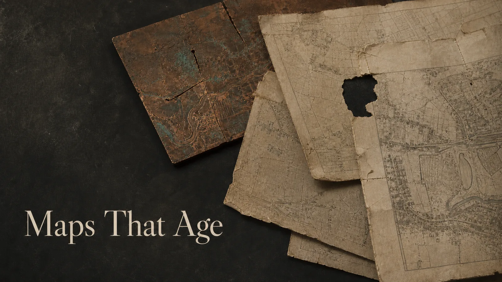
Look long enough and the engraved surface begins to disclose other clocks. The hatching around the lower cartouche grows faint. A crack appears near the lower-left corner. Bolts or clamps leave repair traces. The damage is partly mended. Clouds are reworked. A date is added beside Frans Hogenberg’s signature, then altered. Eventually a new plate replaces the old one. That replacement is corrected, and it too gives way to a third copperplate whose successors keep revising it after Ortelius’s death.
Which of those moments does “1570” describe?
The question is not pedantic. Historical maps are often presented as pictures with birthdays. A title, maker and nominal date seem sufficient to identify the object, especially online, where one image file appears perfectly stable. But a printed map belongs to a process. A design is cut into a matrix; the matrix produces impressions; the matrix wears and can be repaired; names and coastlines can be recut; the same state can enter different language editions; an edition can contain a mixture of old and new states. Hand colouring introduces another history, often after printing. Binding, trimming, conservation and scanning add still more.
To say that a map “ages” is therefore not only to observe yellow paper. Age can be made in the plate. It can be edited into the geography. It can be hidden by the publisher’s ability to retain the title, projection and compositional authority of the earlier image while changing details inside it.
This essay follows a deliberately narrow corpus: nine impressions or documented states from the three world-map plates used in Ortelius’s atlas. The restriction is useful. Instead of comparing unrelated maps that happen to bear different dates, we can watch one visual proposition survive physical wear, commercial repetition and geographic revision. The world remains recognisably Ortelian while the copper beneath it refuses to stand still.
 The Map
 The digital image teaches a misleading kind of permanence. It can be copied without wear. Its thousandth display does not pale the first. Unless someone replaces the asset, every visitor receives the same arrangement of pixels. We know files have versions, but the version history is usually external to the picture: a repository commit, a timestamp, a filename with “final-2” appended.
An engraved copperplate stores history differently. Every impression depends on pressure, ink, paper and the current condition of the matrix. Repetition spends the plate. Fine lines become shallow and print weakly. Damage interrupts the surface. Repair can preserve a plate while leaving new marks. Recutting can restore a line but also change it. The matrix is both the source of the image and a material object subject to work.
That distinction gives us four terms.
A plate is the engraved matrix. A state is a materially altered condition of that plate. An impression is a particular print pulled from it. An edition is a publisher’s assembly of maps, text and paratext issued as a named publication. The terms overlap in practice but they are not interchangeable. Hundreds of impressions can share a state. One state can appear in multiple editions. Two copies of the same edition can contain different states if production crossed a moment of alteration or used available stock.
The first Ortelius world-map plate, known in Marcel van den Broecke’s census as Ort 1, was used from 1570 into the mid-1580s. Six states are documented. The second, Ort 2, was comparatively short-lived and is known in three states. The third, Ort 3, carried the composition into the seventeenth century and was altered again. The title Typus Orbis Terrarum persists across all three. So do the broad double-hemisphere oval, the great southern continent, and the philosophical work of placing human affairs inside a contemplated whole.
Persistence is the map’s strength. It is also the source of the archival trap. If a catalogue collapses plate, state and impression under one title, the continuity of the design becomes a continuity of identity. A replacement plate can disappear behind the fact that it depicts “the same” world.
The comparison below sets a high-resolution 1579 impression of the first plate against a reproduction catalogued as 1587, the moment of the second plate’s arrival. It is not a metric registration: the scans differ in crop, colour and resolution. The slider is a looking device. Use the cartouches, clouds and South American outline as anchors, and notice how much can change while the first glance continues to say “Ortelius world map.”


The slider’s incompleteness is part of the lesson. A convincing image comparison does not identify a state by itself. It proposes places to inspect. Identification requires the catalogue history: plate dimensions, inscriptions, known occurrences, repair marks and the relation between editions. Vision becomes evidence only after it is attached to a claim that another reader can check.
 The Theatre
 The first plate does not age evenly. Its documented history reads like a small drama at the margin of a world.
In the first state, the hatching around the lower Cicero cartouche is complete. By a 1574 issue, the hatching beneath its clasps has been augmented in a different direction. In 1575, bolt impressions are documented in the lower-left corner around a crack. By 1579 the crack has been partly mended and made less visible, and some clouds have been reworked. In 1584 a date is added beside the engraver’s signature. The date becomes 1585 after that. Across the sequence, the oblique hatching grows progressively fainter.
None of these alterations announces itself as a new theory of the world. They belong to maintenance: keep the plate printable, keep the cartouche legible, keep a valuable atlas in production. Yet maintenance writes a second image around the first. A reader who knows where to look can see production pressure intersect the philosophical surface.
That surface matters because the map is not only a container for coasts. Lucia Nuti’s reading of the Ortelian world map as emblem and Stoic contemplation directs attention to the quotations and staged act of beholding. The map asks a viewer to consider the whole world and the smallness of human affairs within it. Its frame, cartouches and clouds participate in that argument. When their lines fade or are reworked, material wear touches the theatre through which the geography acquires meaning.
The plate thus remembers two scales at once. It remembers the global design cut into it, and it records local interventions made to keep that design in circulation. A crack in one corner is physically small. Historically, it is evidence of repeated use, commercial value, skilled repair and a decision not yet to replace the matrix.
Calling the crack “damage” is accurate but incomplete. Damage becomes meaningful because someone responds. Bolt impressions imply an attempt to stabilise the plate. A partly mended crack implies further labour. Reworked clouds show that restoration is never merely passive; the repaired image is authored again. A date added beside a signature changes the plate’s statement about time even as the inherited map remains.
This is one reason a pristine-looking digital reproduction can work against historical understanding. High resolution is invaluable: it lets us inspect marks a book display could hide. But a clean interface can turn every state into an equally fresh file. Zoom removes distance; it does not automatically restore sequence. The archive must supply the chronology that the pixels lack.
Colour is especially treacherous. Two surviving impressions may be painted in dramatically different palettes. That difference can be visually overwhelming and historically important, but it does not by itself identify a new plate state. Colouring might be contemporary with publication, applied by a workshop, added by a later owner, or altered in conservation. This essay therefore excludes palette from its plate-state ledger unless evidence ties it to the printing history. What is easy to see is not always what is safe to claim.
The same caution applies to paper tone, stains and trimming. They belong to the life of the impression, not necessarily to the state of the copperplate. “Age” is plural: the matrix ages through printing and intervention; the sheet ages through handling, binding and environment; the atlas ages through revision; the catalogue ages through new identifications. Good description keeps those histories adjacent without collapsing them.
By the middle of the 1580s, maintenance gave way to replacement. The first plate had produced thousands of impressions. Its fine hatching had faded, and its repaired corner carried the history of use. Ort 2 recut the world.
Replacement sounds like rupture, but the business case depended on continuity. The new plate retained the title and the recognisable form of the atlas’s opening map. A buyer did not encounter an alien world picture. The publisher renewed a successful image while preserving its authority.
Ort 2 also changed. Its first state was dated 1586 and appears in most copies of the 1587 French edition. The date was then removed. In the third state, associated with the 1588 Spanish edition and later occurrences, the South American coastline was corrected. Clouds remained in the corners, distinguishing this second plate from the third.
The word “corrected” needs restraint. It does not mean the coastline suddenly became correct by modern standards. It means the line was deliberately changed within the publication’s own cartographic history, and that the change was carried forward in the next plate. Correction is a relation between states before it is a verdict from the present.
This is how maps can make change look continuous. A coastline is recut, but the projection, title and composition tell the reader the same object has returned. The world becomes more current without surrendering the visual form that made the atlas recognisable. Revision borrows trust from repetition.
The ledger below separates three categories that a single “updated” label would confuse. Repair responds to material failure. Replacement transfers a design to a new matrix. Geographic revision changes mapped content. One intervention can belong to more than one category, but naming the distinction prevents a repaired crack from becoming evidence of new geographic knowledge or a redrawn coast from being dismissed as routine wear.
Plate-state ledger · documented interventions
One title, three plates, eight visible moments
Filter the ledger by copperplate. Each row separates the intervention from the evidence used to identify it.
Showing all 8 documented moments.
-
1570 · Ort 1, state 1.1
First documented state
Complete oblique hachuring around the lower Cicero cartouche.
Evidence confidence: high
Open catalogue record -
1575 · Ort 1, state 1.3
Plate repair
Bolt impressions appear at the lower-left corner around a crack.
Evidence confidence: high
Open catalogue record -
1579 · Ort 1, state 1.4
Crack mended; clouds reworked
The crack is less visible and cloud linework has been reworked.
Evidence confidence: high
Open catalogue record -
1584 · Ort 1, state 1.5
Date added amid wear
The date 1584 appears beside Hogenberg’s signature while cartouche hachuring has faded.
Evidence confidence: high
Open catalogue record -
1587 · Ort 2, state 2.1
Replacement plate
A newly cut plate is dated 1586 and retains clouds in the corners.
Evidence confidence: high
Open catalogue record -
1588 · Ort 2, state 2.3
Coastline corrected
The South American coastline is corrected while corner clouds remain.
Evidence confidence: high
Open catalogue record -
1589 · Ort 3, state 3.1
Third plate replaces predecessors
Corrected South America, four corner medallions and no clouds distinguish the plate.
Evidence confidence: high
Open catalogue record -
1613 · Ort 3, state 3.2
Posthumous geographic update
Le Maire Strait is added, the 1587 date is removed and strapwork hachuring changes.
Evidence confidence: medium
Open catalogue record
The confidence labels are intentionally plain. “High” means the intervention and state are explicitly described in the specialist census. “Medium” marks the later third-plate alteration whose chronology is described as in or after a particular edition. Confidence does not score how attractive the claim is. It records how firmly the project can attach the intervention to a time and state.
Notice also that several ledger rows link to catalogue records without a displayed image. That is a feature, not a failure. A textual state record can be strong evidence that an alteration existed while an available online scan remains too ambiguous to represent it responsibly. Publication should not force evidence into an image-shaped hole.
The Theatrum was a spectacular publishing achievement. The Library of Congress summarises a run of thirty-one editions in seven languages between 1570 and 1612, with more than 7,300 copies printed. Maps of uniform format, descriptive texts and a catalogue of sources made the world available as an organised book.
That organisation encourages a useful fiction: an edition is one fixed thing. Bibliographic language needs the fiction. “The 1570 Latin edition” lets collections, scholars and readers identify a publication without reciting the condition of every sheet in every surviving copy. Trouble begins only when the shorthand becomes an assumption that all constituent maps are materially identical.
Production histories cross edition boundaries. Old stock can be bound with new. A plate may be altered during a print run. A short-lived replacement can appear in some copies while another plate appears in others nominally dated the same. Text on the verso helps identify an edition, but the front can carry a state whose own chronology is not reducible to the title page.
The second world-map plate makes the problem vivid. Its states appear across French, Spanish, German and Dutch contexts, with a few late occurrences. The third plate begins appearing around the same transition and then dominates subsequent editions. An edition label is evidence, but not the final answer to “which map is this?”
The timeline is linear because forty-three years is short enough to show without compression. Even so, it simplifies. The dots mark moments at which the census documents interventions, not neat dates on which every previous state ceased to exist. An impression can be pulled earlier and bound later. A state can survive in a copy long after the plate itself has been altered again. The line is a guide through evidence, not a conveyor belt of universal replacement.
The publication’s theatre reinforces continuity. The world map keeps its privileged opening position. Quotations teach the reader how to behold it. The atlas gathers regional maps behind the whole. New geography enters a familiar stage, where revision can feel like confirmation: the book is still authoritative because it can change, and the changes look authoritative because they occur inside the established book.
Age is therefore institutional. It is produced by decisions about when to keep a plate, when to mend it, when to recut it, which stock to bind, and how to describe the result. The date on the title page coordinates those decisions for sale and cataloguing. It does not erase their plurality.
Put two scans in a slider and the eye immediately begins to measure. A cape has moved. A cartouche is wider. The oval does not align. One coastline looks more confident. Digital tools invite the next step: register the images, subtract one from the other and turn every difference into a number.
That method can be powerful. Van den Broecke notes that superimposing maps can reveal small differences missed when a reader looks back and forth between similar sheets. Overlay interrupts visual memory. It makes the near-identical unstable.
But not every pixel difference is a plate difference. The two scans in this essay have different crops, resolutions, colour balances, lens distortions and states of preservation. Paper can expand or contract. A book gutter can curve one side of a sheet. A camera can introduce perspective. Hand colour can cover linework. Automated registration will happily bend one image until unrelated features appear to agree, then report the residual as though it were historical truth.
Responsible Cartometry begins with a claims ledger, not an error chart. Each observed feature needs a target, a comparison pair, a method, a unit, a confidence level and a source. “South American coastline changed” is defensible when tied to the specialist state description and visible anchors. “The coastline improved by 2.7 percent” would require a declared geographic reference, comparable scans and a definition of improvement. This essay does not yet possess that evidence, so it does not manufacture the precision.
Cartometry Bench · evidence before precision
Documented interventions accumulate
The measure counts cited changes in the plate lineage. It does not calculate geographic or pixel error across unlike scans.
The accumulating error worth charting first is not deviation from a modern coastline. It is the growing distance between the singular catalogue label and the plural object history. One title hides three plates. One nominal date hides multiple interventions. One edition can hide mixed states. One digital image can hide the condition of its matrix, sheet, colouring and scan.
This does not make measurement impossible. It changes the unit. Count documented interventions by category. Record the interval between first use and alteration. Track which claims rest on visible scan evidence and which on catalogue authority. Expose missing images instead of coding them as zero change. Such a dataset can be exported, reviewed and improved without pretending that absence is measurement.
The state explorer already uses that structure. Its future data export will preserve the state ID, year, plate, intervention, evidence and confidence shown to the reader. An external analyst should be able to reproduce the visible ledger from the file. The chart must remain downstream of the evidence, never a decorative authority floating above it.
Measurement is most honest here when it tells us what it cannot compare.
The archive does not merely receive an old map. It helps produce the map’s age.
A cataloguer distinguishes an impression from an edition. A conservator records repairs that might otherwise be mistaken for plate work. A bibliographer compares verso text across copies. A specialist notices that two almost identical maps came from different plates. A digitisation team makes a mark available at a scale its original readers may never have inspected. A rights statement determines whether the comparison can circulate. Each act adds structure to the object’s past.
That structure remains provisional. Van den Broecke’s plate index explicitly records states discovered after the publication of his 1996 guide and expects more to be found. The catalogue ages too. Its authority comes not from being final but from making revision accountable.
The third Ortelius plate offers a fitting end. It replaced the earlier world maps, carried their corrected South America, changed clouds into corner medallions and continued through later editions. In or after the 1613 Dutch edition, Le Maire Strait was added and the 1587 date removed. The world map now registered information from beyond Ortelius’s lifetime while retaining his name, title and encompassing form.
This is not a story in which an inaccurate old map steadily becomes a correct modern one. The great southern continent remains. The emblematic world remains. Sources, commercial judgement and inherited graphic choices remain layered into every revision. New information enters through the same form that naturalises the old.
Nor is it a story in which physical decay simply defeats the image. Wear prompts repair. Repair prolongs use. Replacement renews the design. Revision makes the atlas current enough to keep selling and familiar enough to keep trusting. Age is not the enemy of authority here. Managed age is one of authority’s techniques.
The question to carry into the collection is therefore small and disruptive: which state?
Ask it after the title. Ask it after the maker and date. Ask whether the displayed scan proves the identification or only illustrates the family. Ask whether a colour belongs to the press, the workshop, a later owner or the scanner. Ask which marks come from copper, paper, binding and repair. Ask what an edition label coordinates and what it conceals.
The singular map will not disappear. We need titles to find things, dates to order them and makers to study responsibility. But the singular can become a doorway rather than a verdict. Behind “Ortelius, 1570” stands a material sequence: a plate cut, printed, worn, bolted, mended, reworked, dated, replaced, corrected and inherited.
The copperplate remembers because people kept changing it. The archive remembers when it lets those changes remain visible.
Continue through The Archive, compare the atlas as theatre in The Theatre, or inspect every secured impression in the collection.
Sources and evidence
The plate and state sequence follows Marcel van den Broecke’s updated records for Ort 1, Ort 2 and Ort 3 and his plate-index method note. Publication totals and the digitised 1570 atlas come from the Library of Congress Geography and Map Division. The philosophical reading is informed by Lucia Nuti’s “The World Map as an Emblem.” Public-domain reproductions are credited in their catalogue records. Dates attached to scans and dates attached to states are not silently treated as the same evidence.