
Room 7 of 7
The Theatre
Philosophy, knowledge, and abstraction - mapping as a way of staging the world.
Named for Ortelius’s Theatrum Orbis Terrarum, this is the room where the map stops pretending to be the world and admits that it stages one. The Theatre gathers cartography as philosophy - mapping as a way of thinking, a theatre in which knowledge itself is set out for viewing, arranged and lit and framed. It asks what it means to abstract the world into a system: to plot fifteen centuries of maps not on a timeline of progress but as coordinates in a space of values, or to build an essay whose every component stages an argument about a map rather than reproducing one. Here the map is openly a performance of knowledge, with all a performance’s selection and artifice. We ask what is gained when the world is made into a spectacle to be understood - and what such staging quietly leaves in the wings.
The room's anchor
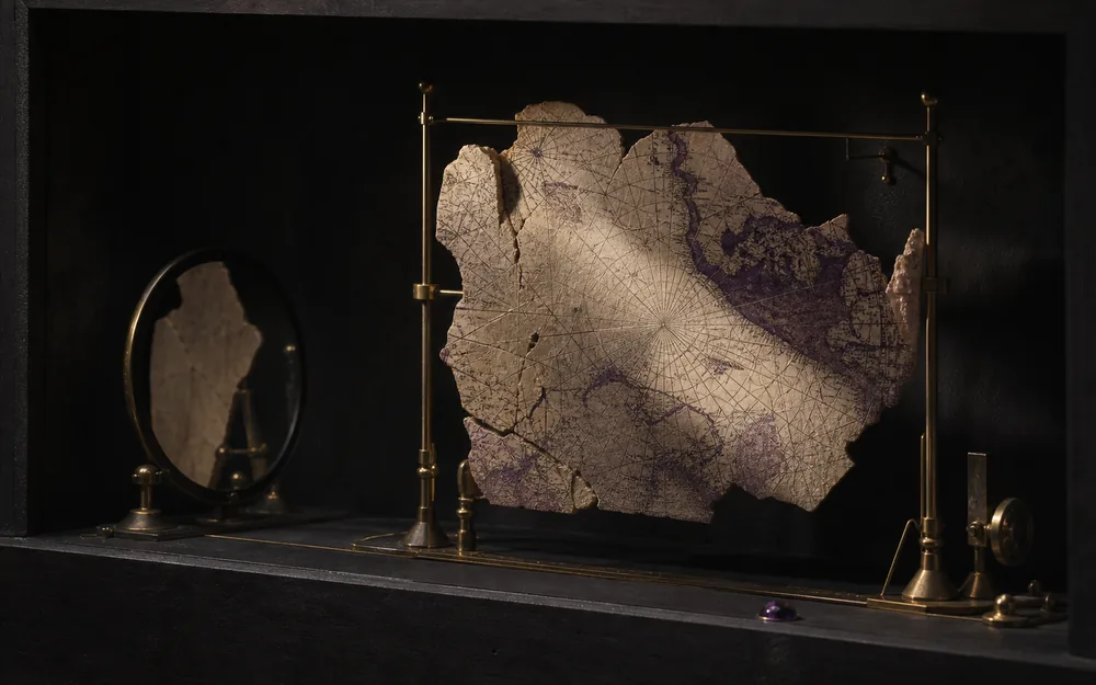
Invisible Maps of Religion
Sacred Space Before the Border
Nine Christian maps from Madaba to Bünting show how a centre, an orientation or a chain of stations can organise lived space without measured distance.
Essays in this room
Essays that pass through
Chapters in this room
- The comparison desk in Terra Sigillata · Lapidarium Dacicum
- The instrument - any chart against any survey in La Rotta e il Catasto
- The fiction of the edition in Maps That Age
- A centre is an instruction in Invisible Maps of Religion
- When east is up in Invisible Maps of Religion
- The world as simultaneous history in Invisible Maps of Religion
- The boundary of this argument in Invisible Maps of Religion
- The city performs itself in Cities Remember
- The church that is both in Terra Sigillata · Lapidarium Dacicum
- Section comparison in Terra Sigillata · Lapidarium Dacicum
- Wear writes itself in Maps That Age
- The archive makes age in Maps That Age
- Print remembers the diagram in Invisible Maps of Religion
- Remove the network in The League That Left No Map
Atlas layers
- Terra Australis, the conjectured south (unreviewed) The region within which early modern maps drew a southern continent, as a schematic envelope rather than a coastline. No map in the register has been examined, so there is nothing to digitise, and drawing a plausible outline would manufacture the confidence this layer exists to question.
- Antarctic expedition tracks (unreviewed) Where ships went, and how they got there. A planned crossing, a voyage under sail and a drift with the ice are three different kinds of line, and the encoding says which is which: nothing here that Terra Chartarum drew is rendered as though a source had given it.
- Antarctic observations and fixes (unreviewed) Dated positions from Cook to the loss of Endurance: farthest souths, the contested sightings of 1820 and 1840, the nineteenth-century landfalls and the Endurance sequence. A sighting is filed as a report rather than an observation wherever what was seen is still argued over.
- Ghost geographies (contract only, no positions located) Features claimed, mapped and later removed, held with their original evidence rather than as a list of mistakes. The layer is currently empty: five ghost features are recorded and not one of their disputed positions has been located, so none carries geometry.
Collection sheets
- Babylonian World Map The Imago Mundi - earth as a disc ringed by the bitter river.
-
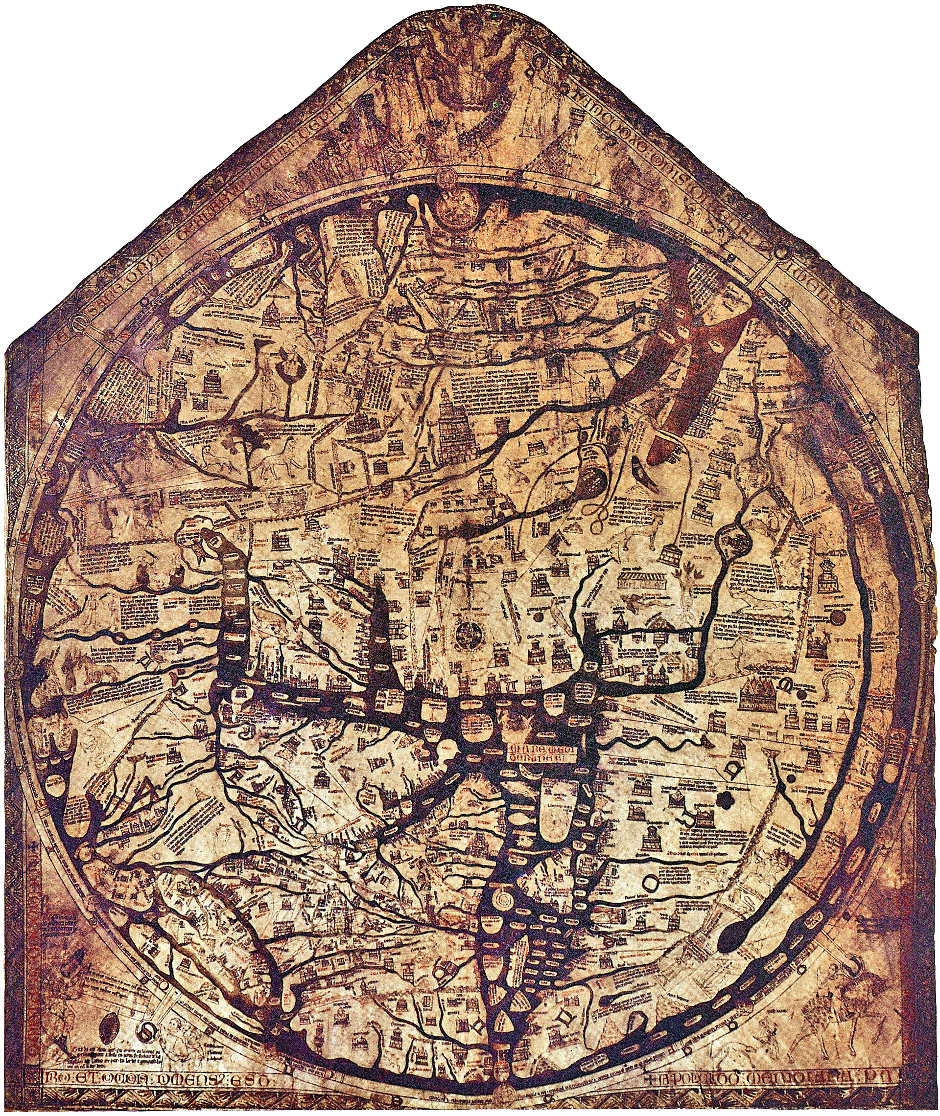 Hereford Mappa Mundi An east-up, encyclopedic Christian world gathered around Jerusalem on a single monumental skin.
 -
 Madaba mosaic map, Jerusalem detail A sixth-century church-floor mosaic enlarges Jerusalem into a legible sacred city and destination.
 -
 Saint-Sever Beatus world map An east-up world in an Apocalypse commentary joins geography to apostolic and sacred history.
 -
 Ebstorf world map Known through photographs and facsimiles, the monumental world was figured within the body of Christ.
 -
 Psalter world map A compact east-up world image makes encyclopedic sacred geography available inside devotional reading.
 -
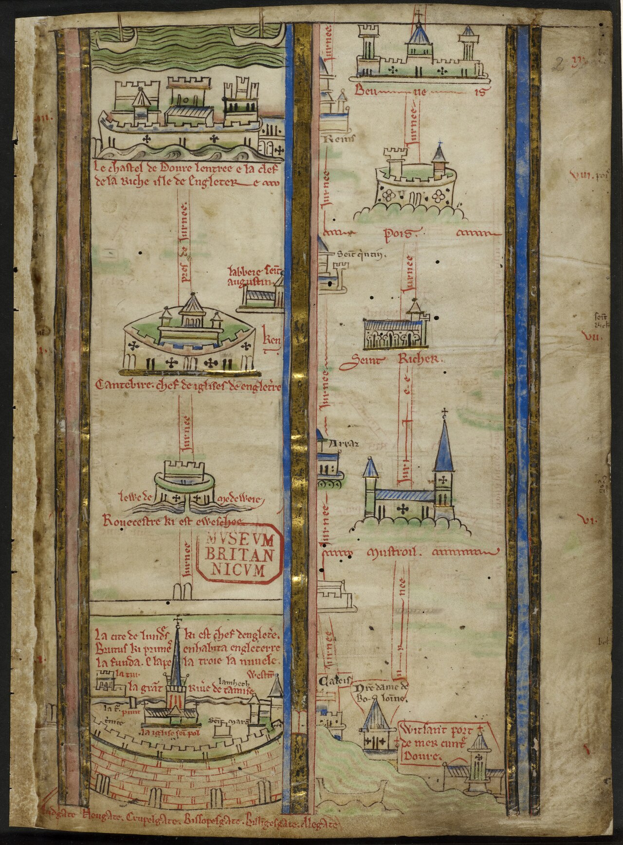 Itinerary from London toward Jerusalem Matthew Paris turns pilgrimage into a vertical sequence of cities, seas and stations rather than a uniform surface.
 -
 T–O map in the first printed Etymologiae A small woodcut transmits an inherited tripartite world as a portable printed diagram.
 - World map in the Rudimentum Novitiorum An incunable combines universal history, genealogical apparatus and printed world maps in one book.
-
 The world in a clover leaf Bünting arranges three continents as a Christian emblem whose leaves meet at Jerusalem.
 -
 Fra Mauro world map Venice's encyclopaedic world, drawn south-up.
 - Portolan atlas of nine charts and a world map Battista Agnese’s workshop joins navigational charts and a world map in a richly illuminated Venetian atlas.
-
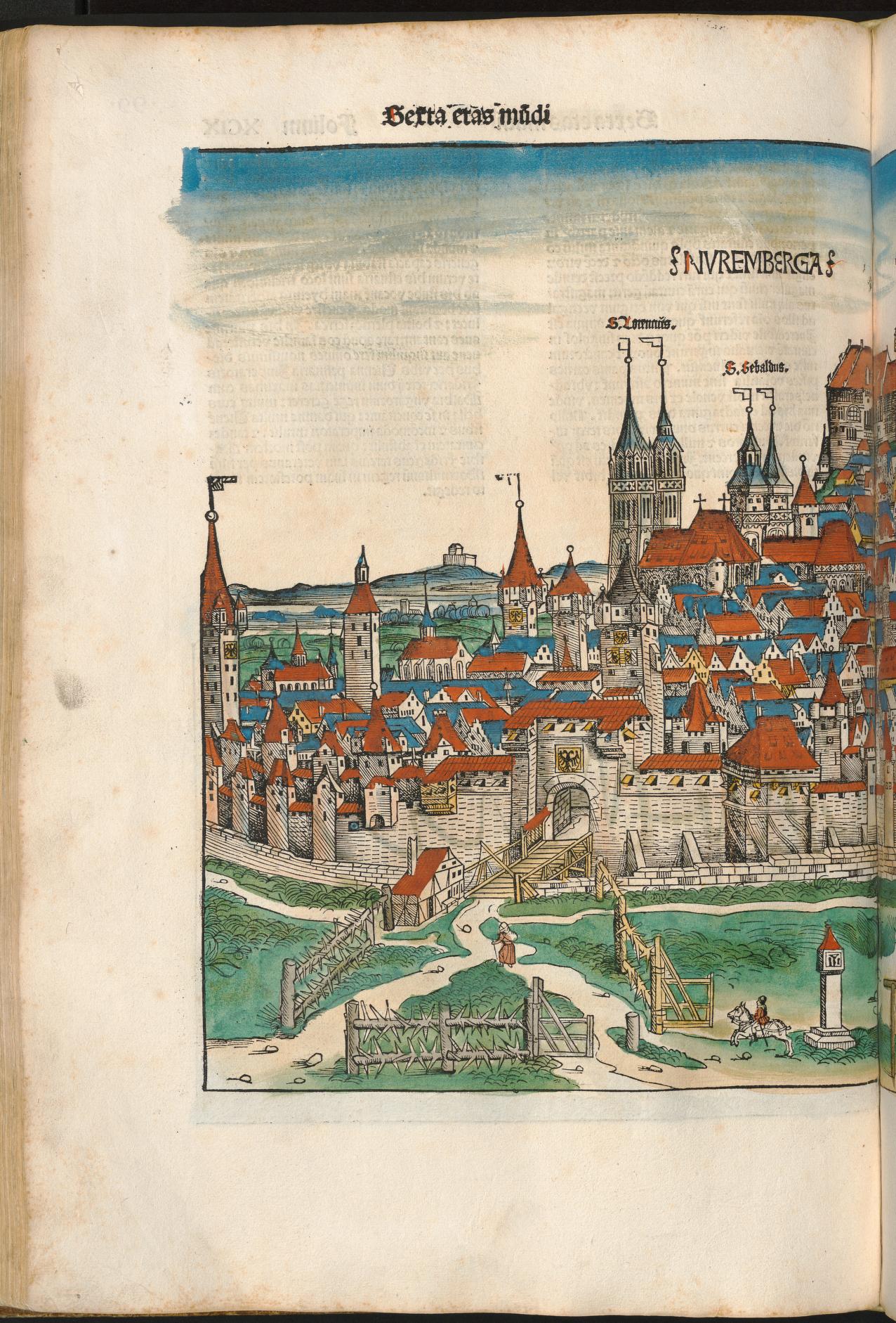 Nuremberg in the Liber Chronicarum A coloured chronicle-page view remembers Nuremberg through wall, gate, church towers and concentrated civic profile.
 - Civitas Londinum (the Agas map) A bird’s-eye woodcut tradition makes early modern London searchable as streets, gates, buildings and river traffic.
- Civitates Orbis Terrarum Braun and Hogenberg’s six-volume atlas makes hundreds of urban plans and prospects available as a repeatable comparative genre.
-
 Plan de Turgot Twenty sectional plates assemble an oblique, building-by-building performance of eighteenth-century Paris.
 -
 Typus Orbis Terrarum, plate 1, state 1.1 The first documented state of Ortelius’s opening world map, before wear and repair accumulated on its copperplate.
 -
.jpg?width=1600) Typus Orbis Terrarum, plate 1, state 1.4 The repaired crack and reworked clouds make this high-resolution impression the essay’s witness to managed age.
Typus Orbis Terrarum, plate 1, state 1.4 The repaired crack and reworked clouds make this high-resolution impression the essay’s witness to managed age. -
 Typus Orbis Terrarum, plate 2, state 2.1 The short-lived second plate renews the familiar composition while preserving corner clouds and an initial 1586 date.
 - Typus Orbis Terrarum, plate 3, state 3.2 A posthumous state adds Le Maire Strait and removes the old date while retaining the Ortelian world-map identity.
- Ptolemy Geographia Coordinates for 8,000 places - cartography as a table of numbers.
- Waldseemüller World Map The map that first wrote "America".
- Ortelius Theatrum The first modern atlas - the world bound as a book.
- Rudimentum Novitiorum world map, Lübeck copy witness A world map printed in Lübeck names northern regions but does not draw the commercial institution around its press.
- Carta Marina et descriptio septemtrionalium terrarum Olaus Magnus makes the northern seas dense with places, creatures and movement as Hanseatic institutions enter a later phase.