
Room 3 of 7
The City
Civilisation, urbanism, and architecture - space made dense and dwelt in.
When the world is not merely crossed but inhabited, mapping changes its nature. The City is the room of dense, dwelt-in space - the plan, the cadastre, the street named and taxed and zoned. It asks how a place becomes property: how the loose, negotiated ground of everyday life is fixed into parcels, addresses, and jurisdictions that can be owned, sold, and governed. To map a city is to impose a grid on a living settlement, and every grid decides who is legible to power and who slips between its lines. Here we watch civilisation draw itself - walls, blocks, and boundaries as instruments of order and exclusion alike. The urban map promises to make the crowded world knowable; we ask whose knowledge it serves, and whose dwelling it renders invisible in the process.
The room's anchor
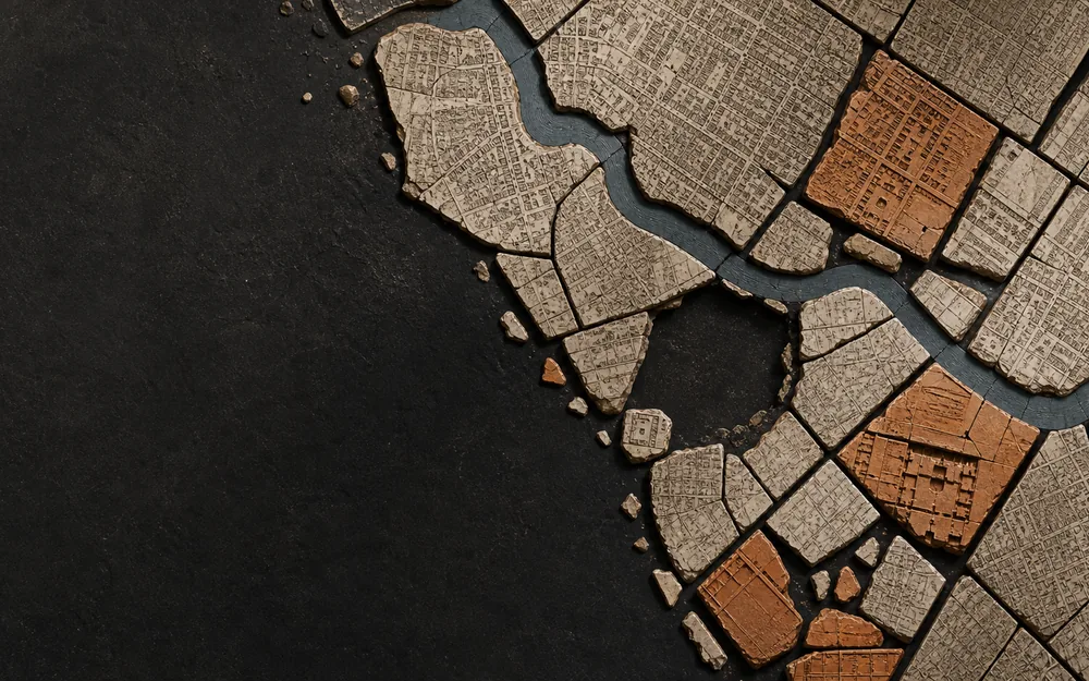
Cities Remember
The Map After the Street
City maps preserve demolished walls, public interiors, property regimes and obsolete risks. Their memory is selective-and an overlay is an argument about what should still be made visible.
Essays that pass through
- Secondary La Rotta e il Catasto Venice, Sicily, and Two Ways of Drawing the Same Sea
- Secondary Invisible Maps of Religion Sacred Space Before the Border
- Secondary The Shape of a Civilization Ground Before Territory
- Secondary The League That Left No Map The Hanseatic League and the Geography of Privilege
Chapters in this room
- Walls after walls in Cities Remember
- Public and private ground in Cities Remember
- Settlement is not sovereignty in The Shape of a Civilization
- Four cities inside other cities in The League That Left No Map
- The city is the unit in The League That Left No Map
- The test pits in Terra Sigillata · Lapidarium Dacicum
- The route, harbour by harbour in La Rotta e il Catasto
- A centre is an instruction in Invisible Maps of Religion
- The road becomes devotion in Invisible Maps of Religion
- The boundary of this argument in Invisible Maps of Religion
- The city survives as a fragment in Cities Remember
- The city performs itself in Cities Remember
- Risk remembers the block in Cities Remember
- An overlay is an argument in Cities Remember
- Water makes a world in The Shape of a Civilization
- Goods draw different leagues in The League That Left No Map
- A sea between cities in The League That Left No Map
Atlas layers
- Hanseatic places and participation phases Sixty source-linked city, market and Kontor phases with historical and modern names and explicit participation classes.
- Hanseatic trade corridors Seven evidence-labelled maritime, riverine, overland and mixed corridors with normalized commodity joins.
- Hanseatic institutional events Privileges, ordinances, embargoes, conflict, treaties, Hansetage, Kontor closures and institutional afterlives.
- The Holy Land as a network: the ports (unreviewed) Four ports the sacred centre was reached, administered and supplied through. The other six records in this register - the world images, the itinerary’s destination, the described land, the gridded sheet and the later emblem - carry no position at all, because what they record is not one.
Collection sheets
-
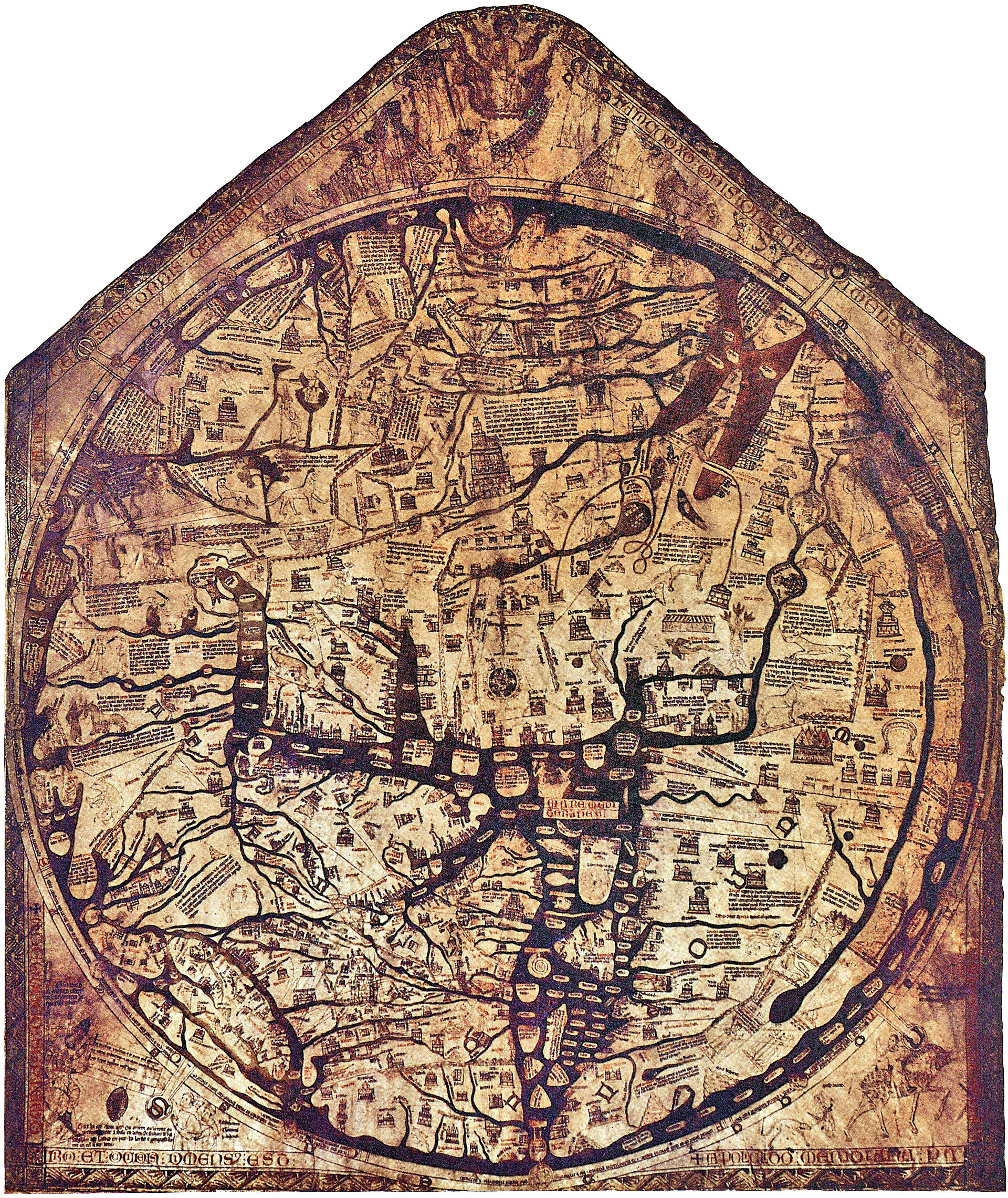 Hereford Mappa Mundi An east-up, encyclopedic Christian world gathered around Jerusalem on a single monumental skin.
 -
 Madaba mosaic map, Jerusalem detail A sixth-century church-floor mosaic enlarges Jerusalem into a legible sacred city and destination.
 -
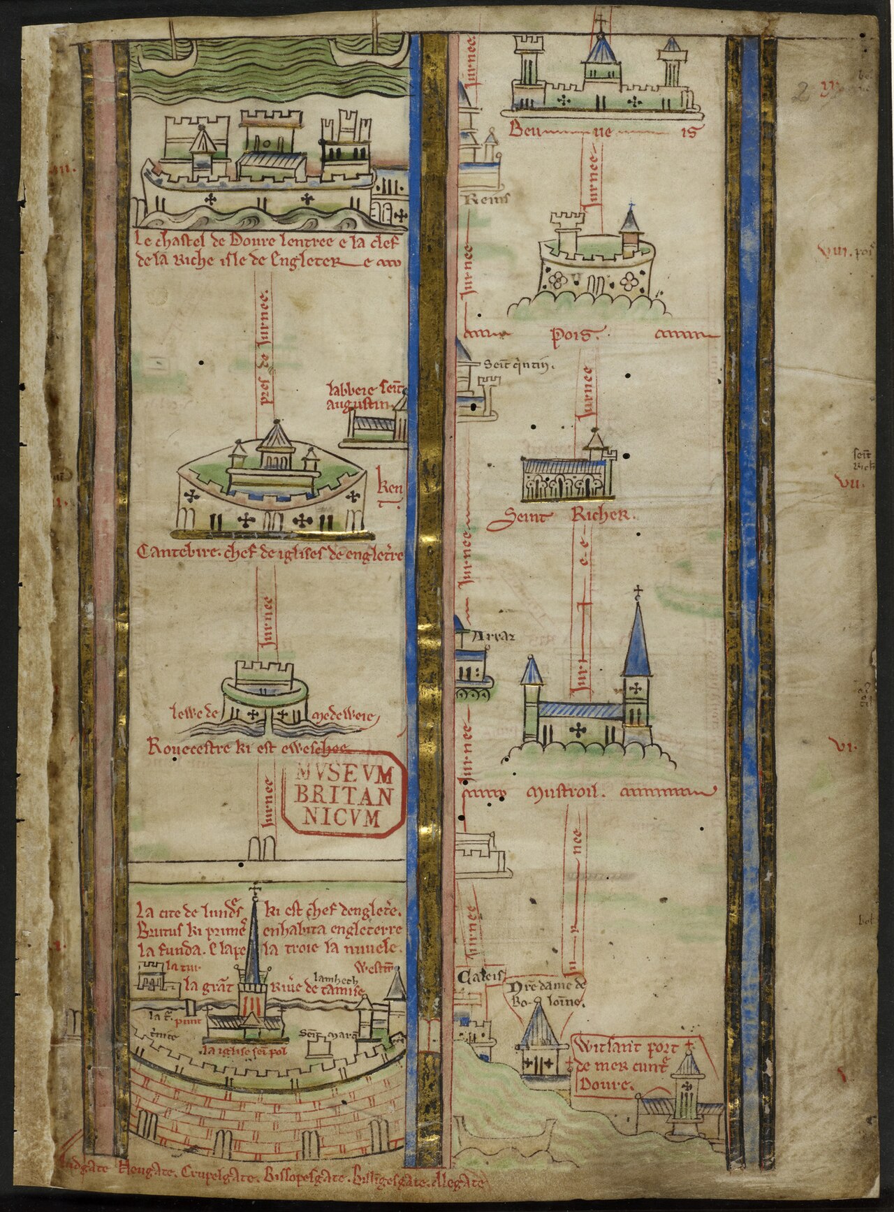 Itinerary from London toward Jerusalem Matthew Paris turns pilgrimage into a vertical sequence of cities, seas and stations rather than a uniform surface.
 -
 The world in a clover leaf Bünting arranges three continents as a Christian emblem whose leaves meet at Jerusalem.
 -
 View of Venice Jacopo de’ Barbari turns the lagoon into an inspectable city while the wider commercial network remains beyond the frame.
 - Forma Urbis Romae The Severan marble plan survives in 1,186 known fragments, turning the mapped city into an evidence problem of joins, proposed locations and absences.
-
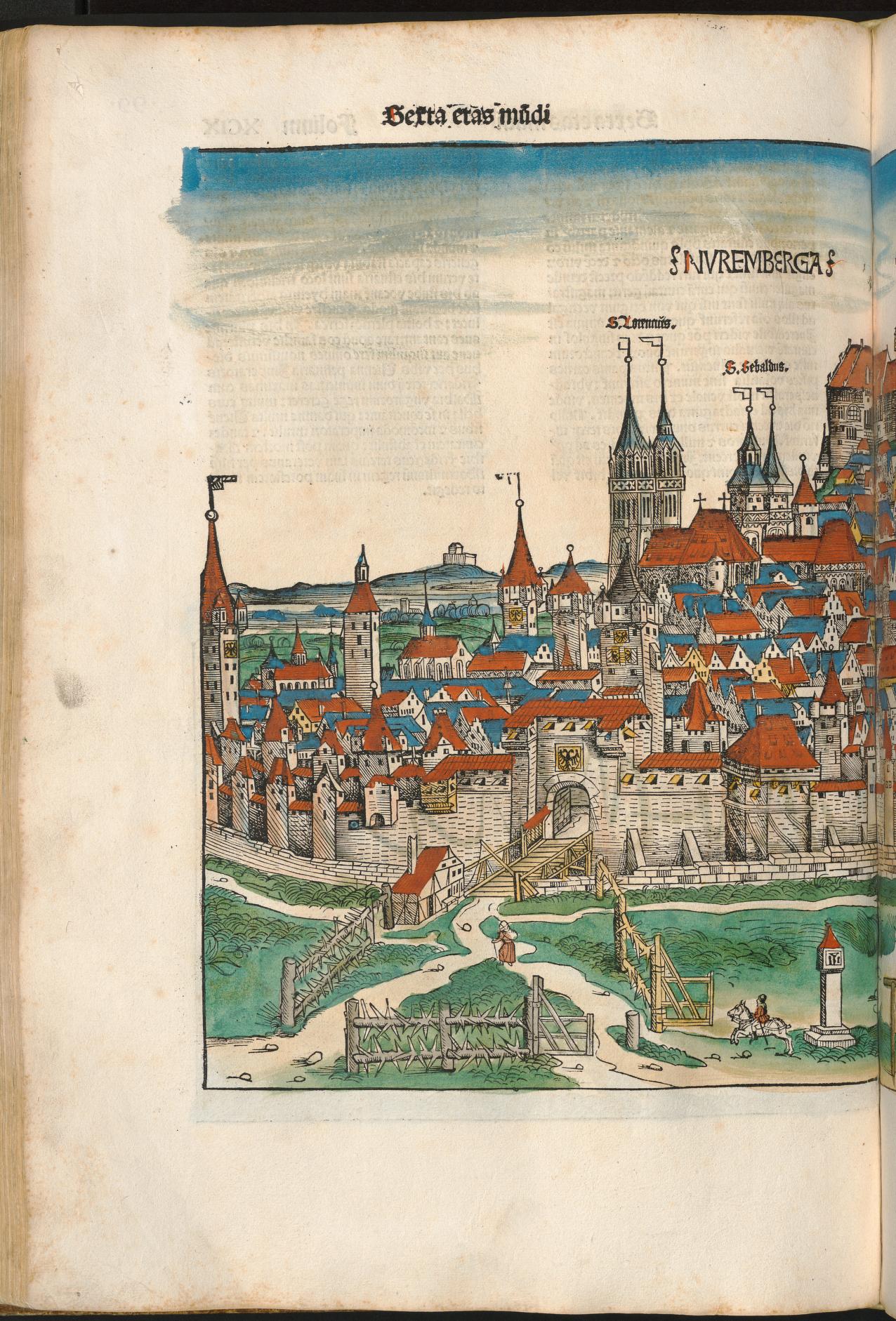 Nuremberg in the Liber Chronicarum A coloured chronicle-page view remembers Nuremberg through wall, gate, church towers and concentrated civic profile.
 -
 Pianta di Roma Bufalini’s large printed plan joins ancient enclosure, papal Rome and surveyed urban fabric on a continuous surface.
 - Civitas Londinum (the Agas map) A bird’s-eye woodcut tradition makes early modern London searchable as streets, gates, buildings and river traffic.
- Civitates Orbis Terrarum Braun and Hogenberg’s six-volume atlas makes hundreds of urban plans and prospects available as a repeatable comparative genre.
-
 Plan de Turgot Twenty sectional plates assemble an oblique, building-by-building performance of eighteenth-century Paris.
 -
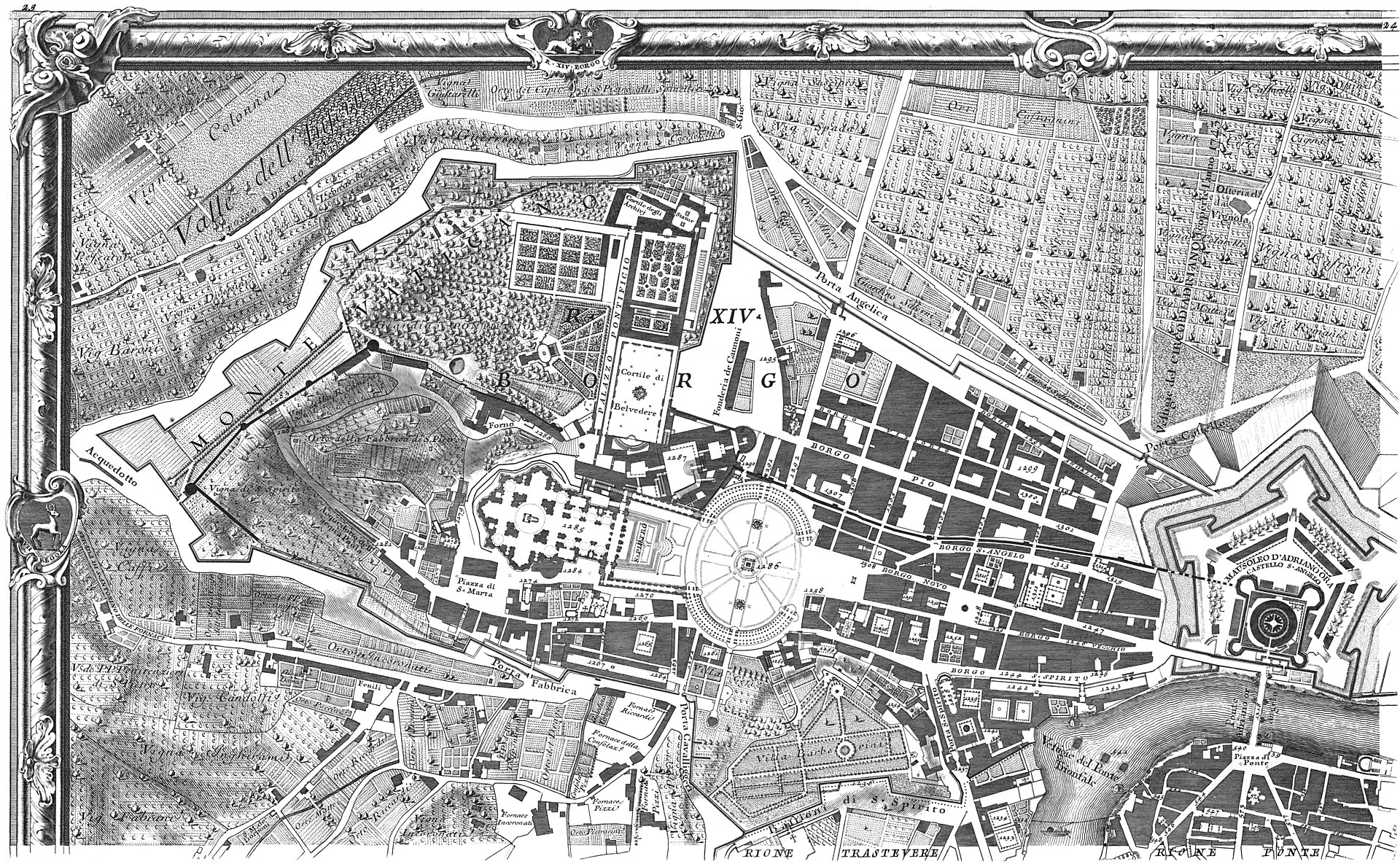 Nuova Pianta di Roma Nolli’s ichnographic plan joins streets and accessible interiors in a white field whose public-private grammar remains inspectable.
 - Sanborn fire insurance map of Buffalo, volume 1 A 110-sheet insurance volume remembers blocks as materials, uses and hazards selected for commercial risk assessment.
- Lübeck, from Civitates Orbis Terrarum, volume I The engraved city portrait calls Lübeck head of the Wendish cities and the Hanseatic society while presenting an autonomous imperial city.
- Hamburg, from Civitates Orbis Terrarum, volume I A river city is made visible as a civic body while the commercial relationships extending beyond it remain implicit.
- London and the Stilliards, from Civitates Orbis Terrarum The London plate pairs an urban view with a text naming the Steelyard, four Kontore and a confederated society of cities.
- Bruges, from Civitates Orbis Terrarum, volume I A circular city portrait describes Bruges as having once been a flourishing emporium without fixing a single date for decline.
- Cologne, from Civitates Orbis Terrarum, volume I The Rhine city’s plate names a league of seventy-two cities and four principal cities, a claim kept distinct from the four Kontore.
- Bremen, from the four-city Civitates plate Bremen appears as a river prospect on a sheet whose Lüneburg panel also names the salt economy behind a major corridor.
- Second Novgorod Schra, Riga copy A sixty-four-article rule text makes Peterhof’s internal discipline visible without turning the merchant compound into territory.
- Bergen Kontor court books, 1633–1759 Nine court books record internal jurisdiction, fees, fire safety, office holders and price lists across Bryggen’s long afterlife.
- London Kontor by-laws, 1554 Thirty leaves regulate elections, jurisdiction, finance, conduct and training inside the Steelyard community.
- Bruges privilege charters, 1458–1502 A charter group records building, staple and excise privileges as negotiated access inside a host city.